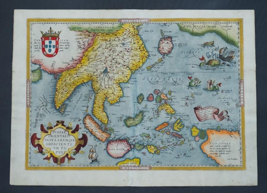
India Orientalis Map, Ortetius, 1570
You must be a subscriber, and be logged in to view price and dealer details.
Subscribe Now to view actual auction price for this item
When you subscribe, you have the option of setting the currency in which to display prices to $Au, $US, $NZ or Stg.
This item has been included into following indexes:
- maps - general 445
Visually similar items

Map, Insulae Indaie Orientalis in Quibus Moluccae Celeberrimae Sunt. Mapmaker Hondius, pub. Amsterdam 1613. Hand coloured engraving. 35 x 4 8 cm

Two early English maps, one by Christopher Saxton, 'Lancastriae 1577' and 'Chester' by John Speed. Each 42 cm x 53 cm.

Map, NSW, New Zealand, New Hebrides & the Islands Adjacent. Robert Wilkinson, pub. London 1808. Inset map of port Jackson & Environs. Coloured engraving
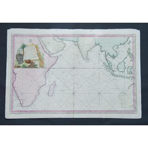
Map, Carte Reduite de L'Ocean Oriental ou Mer des Indes. Mapmaker J N Bellin, pub. Paris, 1757. Hand coloured engraving. 56 x 8 8 cm