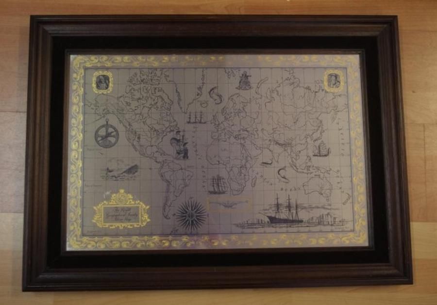
1976 Royal Geographic Society Silver World Map
You must be a subscriber, and be logged in to view price and dealer details.
Subscribe Now to view actual auction price for this item
When you subscribe, you have the option of setting the currency in which to display prices to $Au, $US, $NZ or Stg.
- Circa - A Latin term meaning 'about', often used in the antique trade to give an approximate date for the piece, usually considered to be five years on either side of the circa year. Thus, circa 1900 means the piece was made about 1900, probably between 1895 and 1905. The expression is sometimes abbreviated to c.1900.
Visually similar items

Royal Geographic Society sterling silver world map circa 1976, marked 925/1000, with certificate & paper work, 55 cm x 75 cm (frame)

A lithograph map of Western Australia c.1903 - 04 showing Position of Agricultural Land open for selection & Rainfall Belts. Pether, Governmen Lithographer Perth W.A. 63 x 48.5 cm (poster image size)
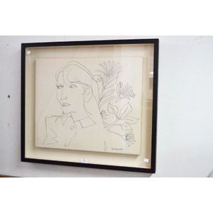
Charles Blackman (1928-.) Australia, pen ink portrait of actor Kate Fitzpatrick from the collection of Kate Fitzpatrick, purchased from John Williams Auctions, approx 50 cm x 60 cm

Map, 'Indiae Orientalis,' VISSCHER. Nicholas VISSCHER (1649-1702) 'Indiae Orientalis nec non Insularum Adiacentum.'. Engraving. 52 x 62 cm