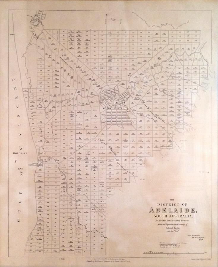
Adelaide District Map, 1840
You must be a subscriber, and be logged in to view price and dealer details.
Subscribe Now to view actual auction price for this item
When you subscribe, you have the option of setting the currency in which to display prices to $Au, $US, $NZ or Stg.
This item has been included into following indexes:
- maps - general 445
Visually similar items

A colonial surveyor's map, 'Plan of the town of Launceston, Van Diemen's Land, from the actual survey by H. W. H. Smythe, 1855', 64 cm high, 78 cm wide

Map, 'Royaume de Hongrie et Pays Adjacents,' par M.Bonne, Andre Scul. Engraving. 25 x 36 cm

Victorian Maps: c1865-92 maps, noted 'New Map of Bendigo & District', 'Township of Sunbury', 'Moe', 'Kororoit', 'Doutta Galla', 'Merino', 'Trawool', 'Blackwood', 'Grassdale', 'Tragowel', 'Goornong', 'Baynton'. Various sizes. Poor/G condition.,
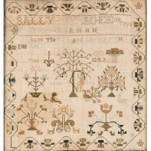
A George III linen cross-stitch needlework sampler, English, 18th century, worked by Sally May and dated 1793. 32.5 cm high, 31 cm wide