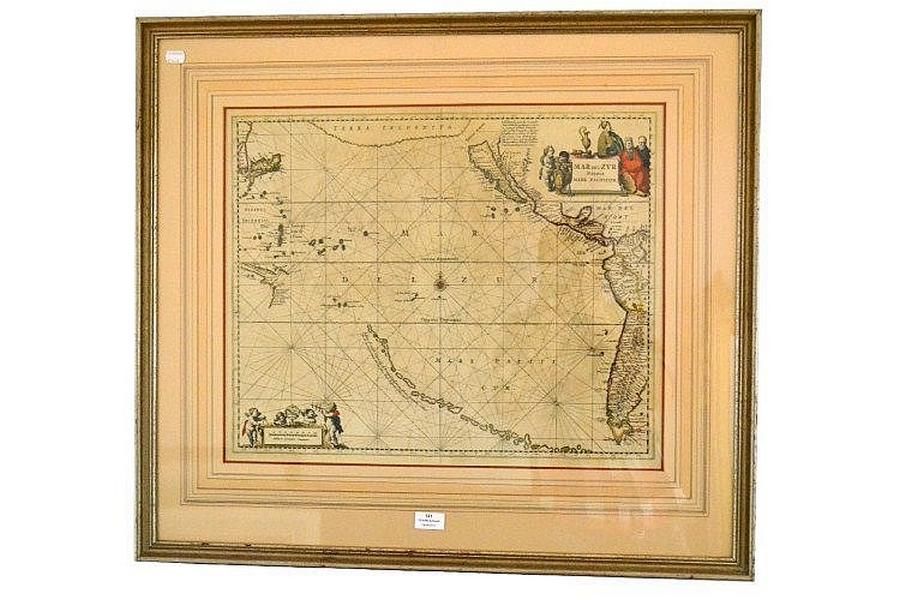
17th Century Jansson Map: Mar del zvr Hispanis Mare Pacificum
You must be a subscriber, and be logged in to view price and dealer details.
Subscribe Now to view actual auction price for this item
When you subscribe, you have the option of setting the currency in which to display prices to $Au, $US, $NZ or Stg.
This item has been included into following indexes:
- maps - general 445
Visually similar items

Chart of Van Diemen's Land, From the Best Authorities, and From Actual Surveys and Measurements', by Thomas Scott (Edinburgh, 1824), (tear at base), impressive musk wood frame, 62 x 87 cm overall. (Tooley 1129). Provenance: Property originally of Thomas Sc

A neddle work floral tapestry in huon pine frame with gilt slip and glass, 19th century, 40 x 35 cm (frame size)

Thomas Griffiths Wainewright (1794-1847) (Attrib), Portrait of a young man, pencil and watercolour, Huon pine frame, 14 x 10 cm. Provenance: Purchased by the present owner at Edwards and Windsor first National Auction, Hobart, Wednesday December 11th, 1985

John Ogilby (1600-1676),the road from London to Montgomery, This antique strip map is from the 'Britannia' by John Ogilby, published in 1675. The colouring is later, ' the road from London to Montgomery.' from Campden to Evesholme to Worcester to hundred h