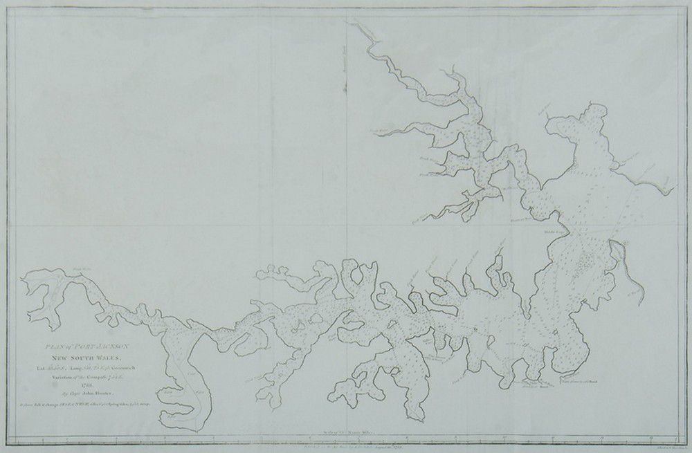
Earliest Plan of Port Jackson, 1789
You must be a subscriber, and be logged in to view price and dealer details.
Subscribe Now to view actual auction price for this item
When you subscribe, you have the option of setting the currency in which to display prices to $Au, $US, $NZ or Stg.
This item has been included into following indexes:
Visually similar items

Thomes Bowen (?-1790) A new and Accurate map of Asia, drawn from the most modern Maps and Charts, 1799 Handcoloured & engraved, for Middletons complete System of Geography 32.5 x 42.5 cm

Louis Kahan: Shearing the Lambs 1982 etching, signed dated and editioned to margin, 40 x 29 cm

1792 Chart of the Coast between Botany Bay & broken Bay. As surveyed by Capt. John hunter. Pub. By John Stockdale, London 1792. Engraving. 43 x 75 cm

Map, 'Royaume de Hongrie et Pays Adjacents,' par M.Bonne, Andre Scul. Engraving. 25 x 36 cm