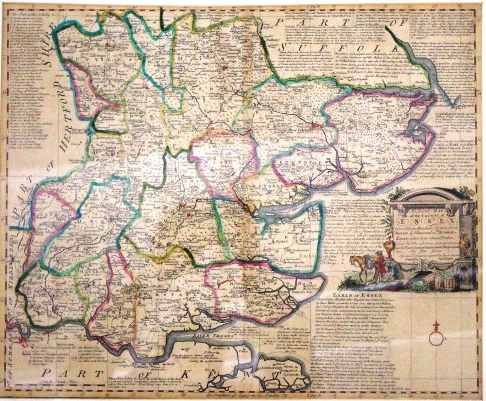
Essex Map 1777 with Historical Extracts and Livings
You must be a subscriber, and be logged in to view price and dealer details.
Subscribe Now to view actual auction price for this item
When you subscribe, you have the option of setting the currency in which to display prices to $Au, $US, $NZ or Stg.
- Circa - A Latin term meaning 'about', often used in the antique trade to give an approximate date for the piece, usually considered to be five years on either side of the circa year. Thus, circa 1900 means the piece was made about 1900, probably between 1895 and 1905. The expression is sometimes abbreviated to c.1900.
This item has been included into following indexes:
Visually similar items

An 18th century map 'Part of Sussex' by Robert Morden, hand coloured in outline. 36 cm x 41 cm

Map, Jannsons china Veteribus Sinarum Regio. Map incorporates Eastern china, Japan, Korea, parts of India & Siam. Pub. Amsterdam 1658. Hand coloured copper engraving, 41 x 51 cm

Map, Mar di India, 1650. Cartographer Jansson, showing from cape of good Hope to Korea, including known parts of new Hollande, pub. Amsterdam, 1650, height and coloured copper engraving, 46 x 57 cm
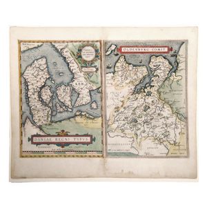
Map, Ortelius, Daniae Regni Typus. 2 Maps, Denmark by Anthoniszoon & Oldenburg Commit. Pub. By Ortelius, Antwerp, 1598, 35 x 50 cm