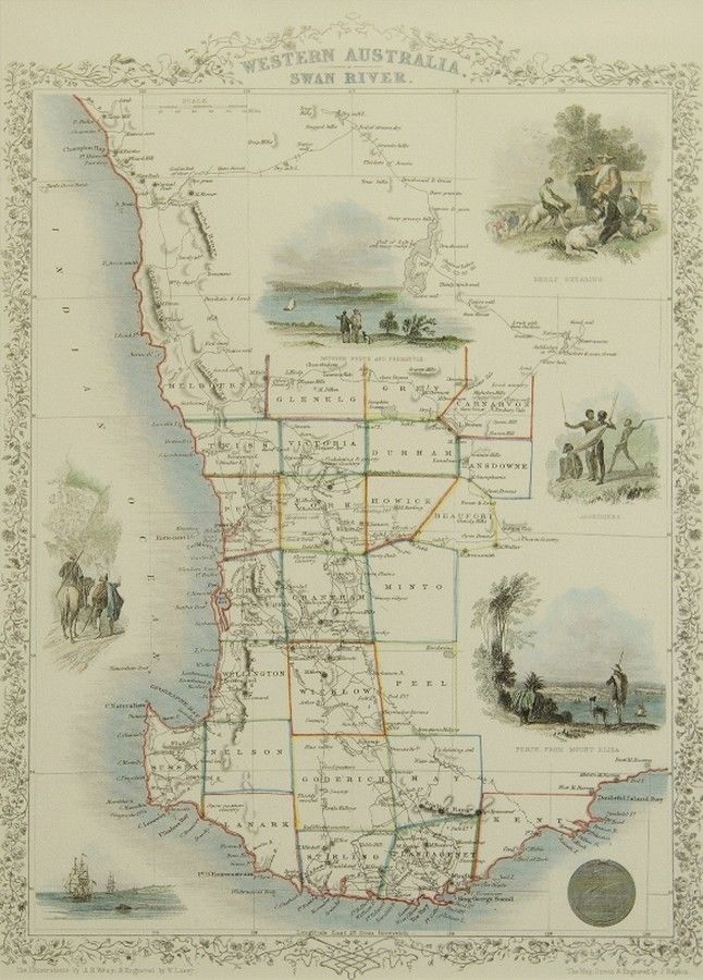
Western Australia Map by J. Rapkin
You must be a subscriber, and be logged in to view price and dealer details.
Subscribe Now to view actual auction price for this item
When you subscribe, you have the option of setting the currency in which to display prices to $Au, $US, $NZ or Stg.
This item has been included into following indexes:
- maps - general 445
Visually similar items

An Indo-Persian miniature painting. 19 cm high, 10 cm wide

Boer War Map: Coloured lithograph supplement titled 'The Argus Map Of The Seat Of War In South Africa', published by Wilson & Mackinnon [Melb]. Framed and glazed. Map size 35 x 47 cm. Together with photographs from the Boer War & 5 American Tobacco Co. cig

A rare 1780 'Map of England & Wales by Martha Wiggins' sampler, worked in coloured threads for the various counties, Cheshire, Derby, York, etc., their names in black thread, various sea's and channel's further detailed, an outer border of latitude and lon

Map: Western Australia and van-Diemen's Island a map of Western Australia containing the settlements of swan river and King George sound from recent surveys sent to the Colonial office. The other section of the map depicting van-Diemen Island, published Lo