Maurelle's Route in South-Western Pacific, 1781
click the photo to enlarge
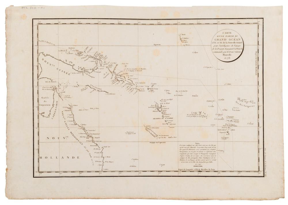
La Perouse 'Carte D'Une Partie Du Grand Ocean a l'E. et S.E. de la Nouvelle Guinee pour l'intelligence du Voyage de la Fregate Espagnole la Princesa commandee par D. Franco. Antonio Maurelle. en 1781.', [Paris, 1797], from the 'Atlas du Voyage de la Perouse' 41.5 x 59 cm (sheet size). A chart of part of the south-western Pacific, showing the routes taken by the Spanish explorer Don Francisco Antonio Maurelle in 1781, along the northern coast of New Guinea and across the Pacific to Fiji and Tonga. The map includes the north-eastern coast of Australia, and parts of the coast of New Guinea. La Perouse had set sail from France in 1785 to continue the discoveries of Captain Cook. He was shipwrecked in 1788 but his narrative, maps, and views survived and were published in 1797.
You must be a subscriber, and be logged in to view price and dealer details.
Subscribe Now to view actual auction price for this item
When you subscribe, you have the option of setting the currency in which to display prices to $Au, $US, $NZ or Stg.
This item has been sold, and the description, image and price are for reference purposes only.
This item has been included into following indexes: