Boroondara County-Bourke: Land Holdings and Revenue Map
click the photo to enlarge
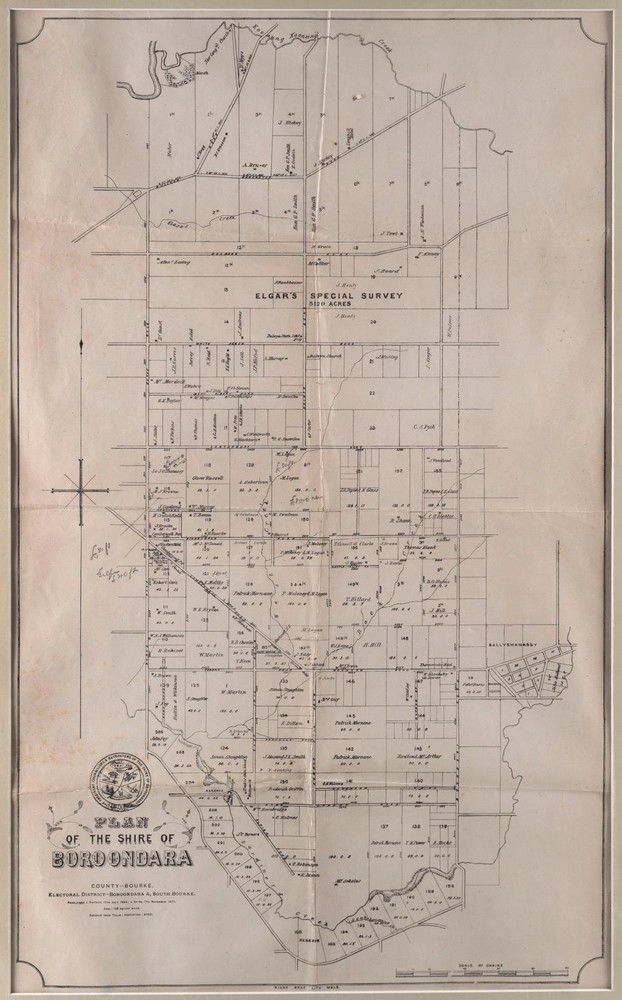
'Plan of the Shire of Boroondara County-Bourke. Electoral District - Boroondara A, South Bourke.' lithgraphed map covering the area from Koonung Creek in the north to Gardiners Creek in the south. Shows individual land holdings and the revenue derived from each named owner. 74 x 43 cm.
You must be a subscriber, and be logged in to view price and dealer details.
Subscribe Now to view actual auction price for this item
When you subscribe, you have the option of setting the currency in which to display prices to $Au, $US, $NZ or Stg.
This item has been sold, and the description, image and price are for reference purposes only.
This item has been included into following indexes:
Visually similar items

Antique 17th century English oak three panel top coffer, carved front frieze and panels to the front, approx 63 cm high, 124 cm long, 57 cm deep
Sold by
in
for
You can display prices in $Au, $US, $NZ or Stg.

Cherry amber earrings on gold hooks
Sold by
in
for
You can display prices in $Au, $US, $NZ or Stg.

1930s ivory bead bracelet with screw clasp
Sold by
in
for
You can display prices in $Au, $US, $NZ or Stg.

Large Chinese bronze archaic vase, with two figural handles & verdigris finish, 46 cm high approx. Provenance: Finey collection, Sydney
Sold by
in
for
You can display prices in $Au, $US, $NZ or Stg.