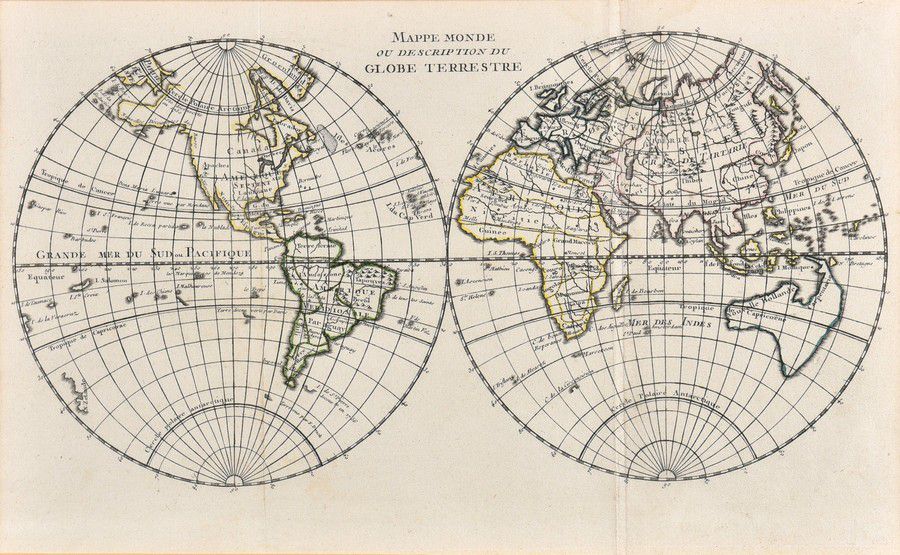
1755 Paris World Map
You must be a subscriber, and be logged in to view price and dealer details.
Subscribe Now to view actual auction price for this item
When you subscribe, you have the option of setting the currency in which to display prices to $Au, $US, $NZ or Stg.
- Circa - A Latin term meaning 'about', often used in the antique trade to give an approximate date for the piece, usually considered to be five years on either side of the circa year. Thus, circa 1900 means the piece was made about 1900, probably between 1895 and 1905. The expression is sometimes abbreviated to c.1900.
This item has been included into following indexes:
Visually similar items

A Chart of the Southern Hemisphere by Captain James Cook, published by William Strahan [London 1777]. 55 x 57 cm

Attributed to Ni Mogeng (Chinese), Kids game ink and watercolour on paper, signed u.l.c. With Chinese characters and stamp, width 54, cm
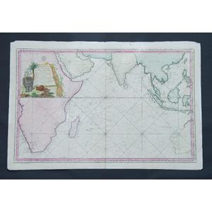
Map, Carte Reduite de L'Ocean Oriental ou Mer des Indes. Mapmaker J N Bellin, pub. Paris, 1757. Hand coloured engraving. 56 x 8 8 cm
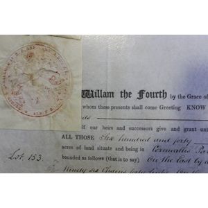
Colonial Tasmanian Land Grant on vellum dated 1837 & signed by Governor George Arthur. Grant to prominent Tasmanian pioneer Edward Bisdee