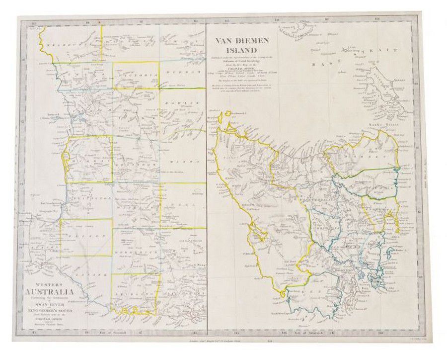
Map of Diemens Island and Western Australia, mid-19th century
You must be a subscriber, and be logged in to view price and dealer details.
Subscribe Now to view actual auction price for this item
When you subscribe, you have the option of setting the currency in which to display prices to $Au, $US, $NZ or Stg.
This item has been included into following indexes:
Visually similar items

Map: Western Australia and van-Diemen's Island a map of Western Australia containing the settlements of swan river and King George sound from recent surveys sent to the Colonial office. The other section of the map depicting van-Diemen Island, published Lo
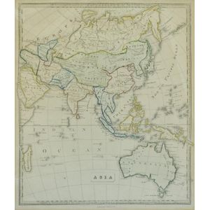
Map, 'Asia (including Australia) 1839.' Allan, Bell & Co. 1837. Engraving. 35 x 30 cm

India: Team sheets / autograph pages (5) for 1983 1st Test v West Indies, 1984 Young India tour to Zimbabwe, 1984-85 5th Test v England, 1985 tour to Australia, 1985 tour to Sri Lanka.

Three Maps. 'Regnum Portugallia', 'Portugal', 'Portugalia Et. Algarve'. By Johannes Baptist Homann, and. Height Moll 1727, and unknown. All hand coloured. 62 x 48 cm, 27 x 20 cm. 19 x 26 cm. Posters