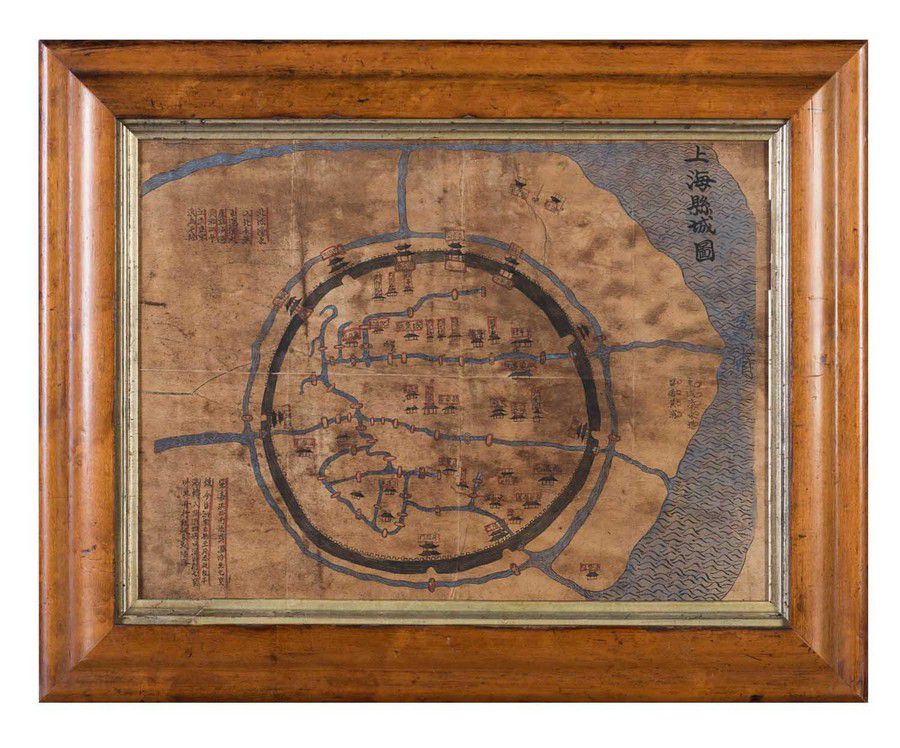
This site contains only a limited number of works of art sold in Australia and New Zealand, and is not representative of the art market for any artist. For a comprehensive art database visit our specialist site, Australian Art Sales Digest which includes over 400,000 works auctioned in Australia and New Zealand by over 30,000 artists, covering the period from the early 1970s to the present day.
A hand-drawn and coloured map of the old city of Shanghai, 19th…
click the photo to enlarge
A hand-drawn and coloured map of the old city of Shanghai, 19th century, ink and pigments on paper, 27.5 x 38 cm, Note: This map shows the Old city of Shanghai as it was in 1555, its boundary defined by a defensive wall 4.8 kilometres around, a moat and nine gates (six land, three water gates). The wall was demolished in 1912 soon after the Republican revolution of 1911. The water way on the right side of the map is the Huangpu river still flowing through the city of Shanghai today, a tributary of the Yangtze River. The Bund is located along the Huangpu River., A similar map published in 1817 is in the collection of the C. Y. Tung Maritime Museum in Shanghai.

You must be a subscriber, and be logged in to view price and dealer details.

Subscribe Now to view actual auction price for this item

When you subscribe, you have the option of setting the currency in which to display prices to $Au, $US, $NZ or Stg.

This item has been sold, and the description, image and price are for reference purposes only.

This item has been included into following indexes:

Visually similar items

Old framed Thanka

Sold by in for
You can display prices in $Au, $US, $NZ or Stg.

Map, Eastern Hemisphere of the earth on a Plane. By J.Hardy, pub. By Newbery, London 1776. Shows van Diemens Land attached to mainland Australia. Hand coloured copper engraving. 24 x 22 cm

Sold by in for
You can display prices in $Au, $US, $NZ or Stg.

A Victorian sampler of traditional form with flowers and poem, signed Mary Tickford, aged 12, 1850. In a bird's eye maple frame. Height 51.5 cm. Width 41.5 cm

Sold by in for
You can display prices in $Au, $US, $NZ or Stg.

Rare 17th century De Rossi, G., Penisola dell India di la dal Gange et Isole intorno ad essa adiacenti, Rome, 1683-1688. Giacomo Rossi's fine late 17th century map of India with Ceylon and Maldives. Issued in Il Mercurio Geografico in lower right hand corn

Sold by in for
You can display prices in $Au, $US, $NZ or Stg.