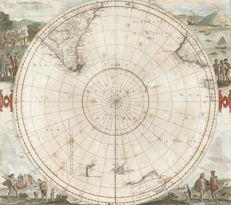
Antarctic Region Map with Tasman's Discoveries
You must be a subscriber, and be logged in to view price and dealer details.
Subscribe Now to view actual auction price for this item
When you subscribe, you have the option of setting the currency in which to display prices to $Au, $US, $NZ or Stg.
- Cartouche - An ornamental panel in the form of of a shield, oval or rectangular scroll with curling edges. It may be carved into the back of a chair or the top of a sideboard, or present on a piece of silver or jewellery, and contain the initials of the original owner, heraldic symbols, or some other inscription, such as the details of a presentation.
In ceramics the term defines the central area of a vase or similar with a decorative border in one of the shapes above, into which a decorative scene or figures have been painted. - Verso - Verso is the "back" side of a sheet of paper, art work, coin or medal. The front side is "recto".
This item has been included into following indexes:
- maps - general 445
Visually similar items

A Chart of the Southern Hemisphere by Captain James Cook, published by William Strahan [London 1777]. 55 x 57 cm

Antique ivory framed miniature painting of lady in red dress with spaniel signed measures 13 cm (image)

Emisfero Terrestre Meridionale, Tagliato Su L'Equatore', map from Zatta's atlas 'Atlante Novissimo' [Venice, 1779], depicts the Antarctic Hemisphere to the equator and Captain Cook's route on his first voyage. New Zealand and the Australian east coast are

Hand painted miniature portrait in ivory style frame, 13 cm x 14.5 cm