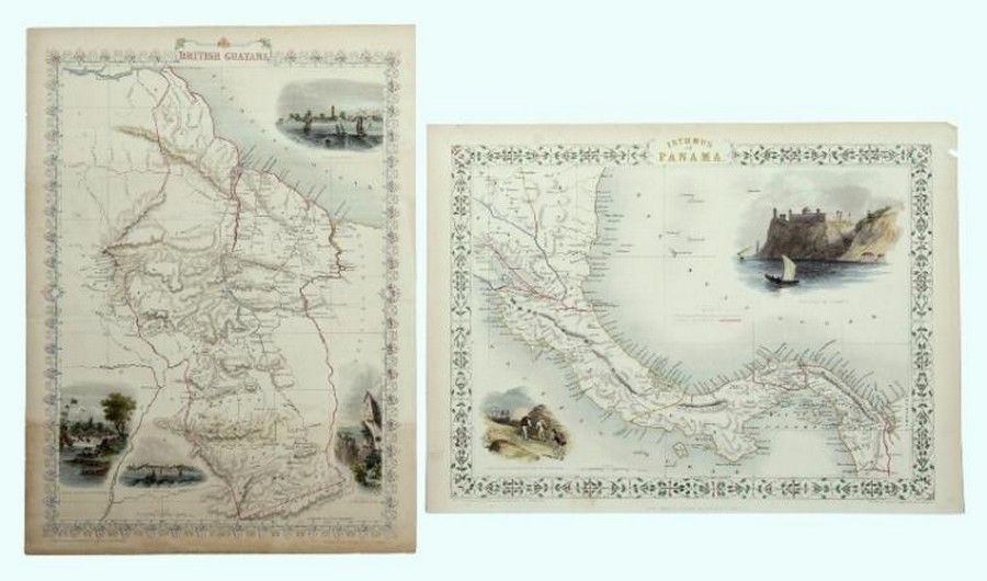
Tallis' 1851 Maps of Panama and British Guayana
You must be a subscriber, and be logged in to view price and dealer details.
Subscribe Now to view actual auction price for this item
When you subscribe, you have the option of setting the currency in which to display prices to $Au, $US, $NZ or Stg.
This item has been included into following indexes:
- maps - general 445
Visually similar items

Maps, two early Maps of Australia. A chart exhibiting recent discoveries from Cook?s Voyages torn at top, together with map of new Holland and Asia, together with 6 other maps Scotland, china etc c.1800. Maps (8). 32 x 27 cm (average)

Chart of Van Diemen's Land, From the Best Authorities, and From Actual Surveys and Measurements', by Thomas Scott (Edinburgh, 1824), (tear at base), impressive musk wood frame, 62 x 87 cm overall. (Tooley 1129). Provenance: Property originally of Thomas Sc

Antique map dated 1690 by Richard Brome of south Wales, approx 38 cm x 47 cm

Maps (2), Australia and NSW. Australien by Petermann, pub. By Justus Perthes, Germany 1871. Has inset Map of port Jackson; and NSW pub. By Tallis & Co. London c.1853. Hand coloured with Three pictorial vignettes. Hand coloured steel engraving (2). 36 x 43