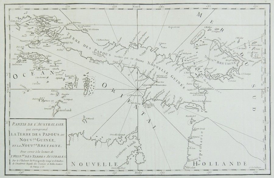
Australia: Papuan and Brittany Lands, 1756
You must be a subscriber, and be logged in to view price and dealer details.
Subscribe Now to view actual auction price for this item
When you subscribe, you have the option of setting the currency in which to display prices to $Au, $US, $NZ or Stg.
This item has been included into following indexes:
- maps - general 445
Visually similar items

Victorian Railways Railway Survey Plans/Maps, published in Melbourne 1879-1913: - Goulburn Valley Line (Murchison to Shepparton); Inglewood & Charlton Line; St.Arnaud and Donald Line; Shepparton & Numurkah Line; Numurkah and Cobram Line; Numurkah and Natha

Hawthorn: autograph page signed by 1934 team, with 22 pencil signatures including Bert Mills & Bert Chandler.

Map: 'Chart of the Pacific Ocean' circa 1820 showing New Holland with incomplete northern and southern coastlines and only the east coast of Van Diemen's Land; Papua or New Guinea largely incomplete; Japan, Philippines, eastern China and the north and sout

1932 India Team to England, autograph page with 16 signatures including C.K.Nayudu (Captain), Janardan Navle, Naoomal Jaoomal, Syed Wazir Ali, Jahangir Khan & Amar Singh; together with team picture