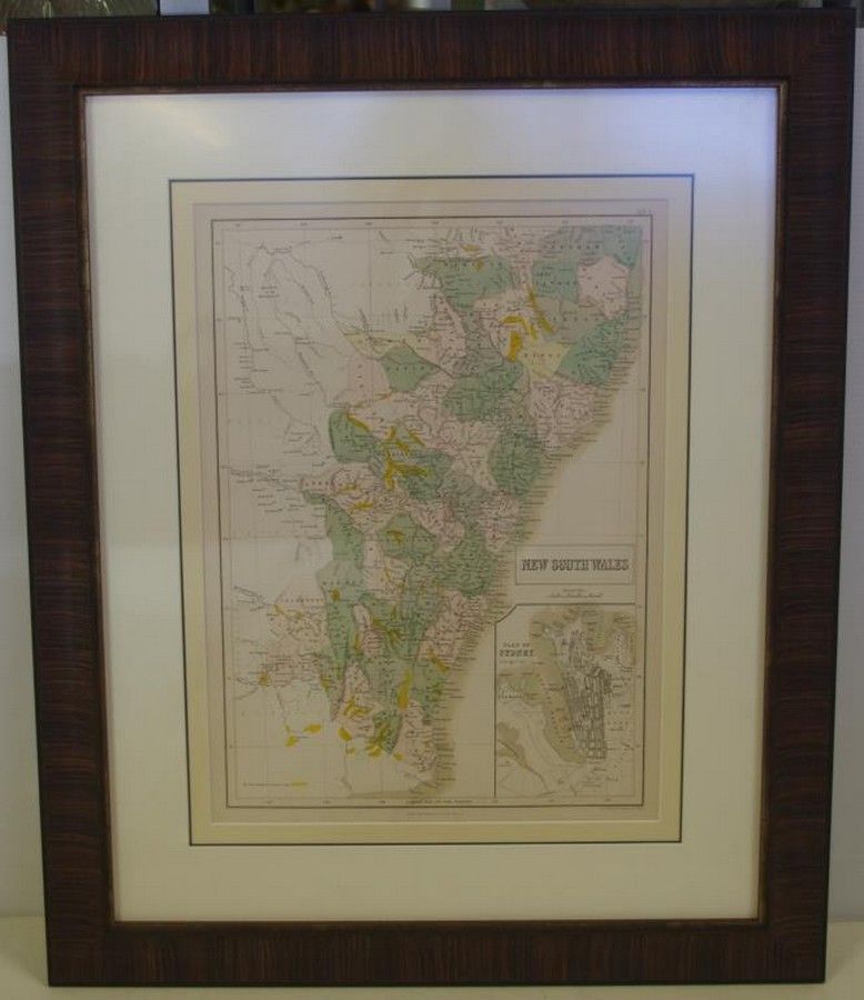
1853 NSW Gold Fields Map in Frame
You must be a subscriber, and be logged in to view price and dealer details.
Subscribe Now to view actual auction price for this item
When you subscribe, you have the option of setting the currency in which to display prices to $Au, $US, $NZ or Stg.
This item has been included into following indexes:
- maps - general 445
Visually similar items

Cedric Emanuel (1906-1995) on the Slips 2 1942/1981 etching (blue) ed. 1/90, signed & dated lower right, 33 x 19 cm

Chart of Van Diemen's Land, From the Best Authorities, and From Actual Surveys and Measurements', by Thomas Scott (Edinburgh, 1824), (tear at base), impressive musk wood frame, 62 x 87 cm overall. (Tooley 1129). Provenance: Property originally of Thomas Sc

A pair of floral prints in oak frames, circa 1910, 60 x 30 cm each

Maps (2), Australia and NSW. Australien by Petermann, pub. By Justus Perthes, Germany 1871. Has inset Map of port Jackson; and NSW pub. By Tallis & Co. London c.1853. Hand coloured with Three pictorial vignettes. Hand coloured steel engraving (2). 36 x 43