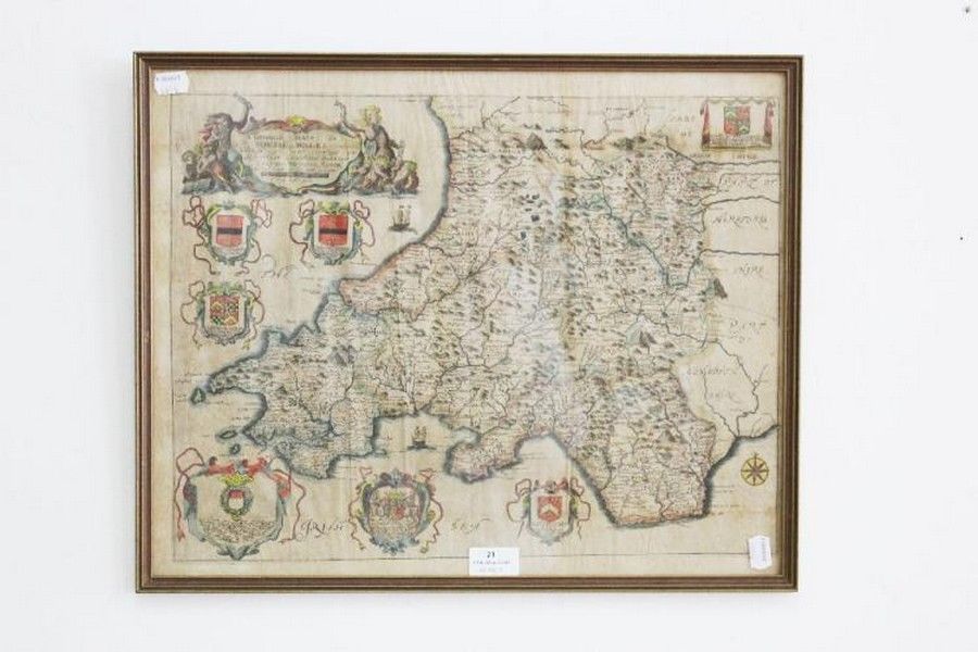
1690 Richard Brome Map of South Wales
You must be a subscriber, and be logged in to view price and dealer details.
Subscribe Now to view actual auction price for this item
When you subscribe, you have the option of setting the currency in which to display prices to $Au, $US, $NZ or Stg.
This item has been included into following indexes:
- maps - general 445
Visually similar items

Book, 'Arthur Rackham's Book of Pictures,' published William Heinemann, 1923, with dust jacket

Rare J. Bleau antique map of the entire Middle East with Arabia prominent. Region: Maps of the Middle East, Turkey and Central Asia, mapmaker: J. Bleau. Place and date of publication: Amsterdam 1640. Medium and colour: copperplate, hand coloured. 41 x 52 c

Map, East India & Australia c1700. Africa to Japan incl. Australia. Made by van Kenlen, Amsterdam. Staining, watermarks & a few holes near the margins. Rebacked. Hand coloured engraving. 53 x 6 0 cm

Map, Jannsons china Veteribus Sinarum Regio. Map incorporates Eastern china, Japan, Korea, parts of India & Siam. Pub. Amsterdam 1658. Hand coloured copper engraving, 41 x 51 cm