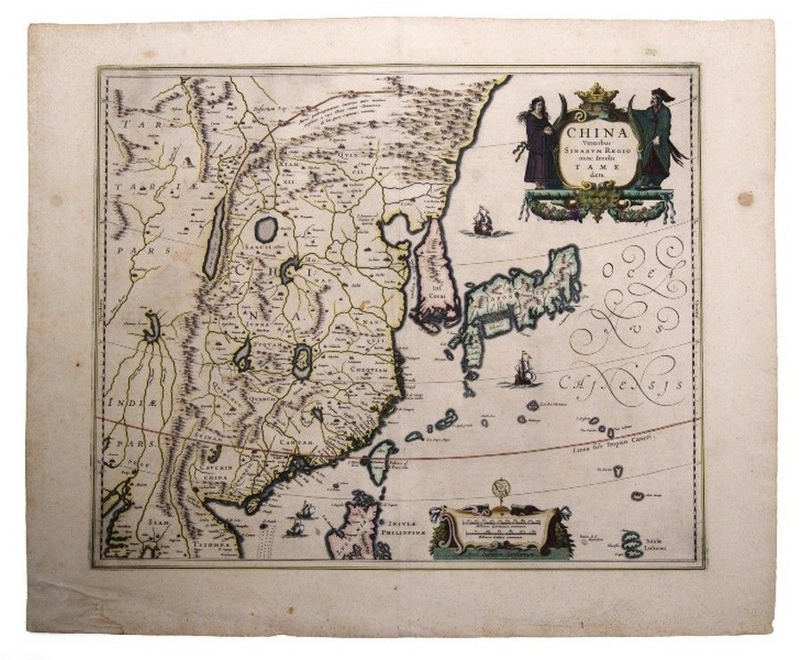
Jannson's Map of Ancient China and Neighboring Regions
You must be a subscriber, and be logged in to view price and dealer details.
Subscribe Now to view actual auction price for this item
When you subscribe, you have the option of setting the currency in which to display prices to $Au, $US, $NZ or Stg.
This item has been included into following indexes:
- maps - general 445
Visually similar items
Map, India Quae Orientalis et Insulae Adiacinte. Mapmaker, Willem Janszoon Blaeu, c.1635. Engraving. 43 x 5 2 cm

Map, Asia, Joannem de ram Novatotius Asiae Tabula, published Amsterdam c.1690. Hand coloured engraving. 46 x 5 7 cm

Thomes Bowen (?-1790) A new and Accurate map of Asia, drawn from the most modern Maps and Charts, 1799 Handcoloured & engraved, for Middletons complete System of Geography 32.5 x 42.5 cm

Rare 17th century De Rossi, G., Penisola dell India di la dal Gange et Isole intorno ad essa adiacenti, Rome, 1683-1688. Giacomo Rossi's fine late 17th century map of India with Ceylon and Maldives. Issued in Il Mercurio Geografico in lower right hand corn