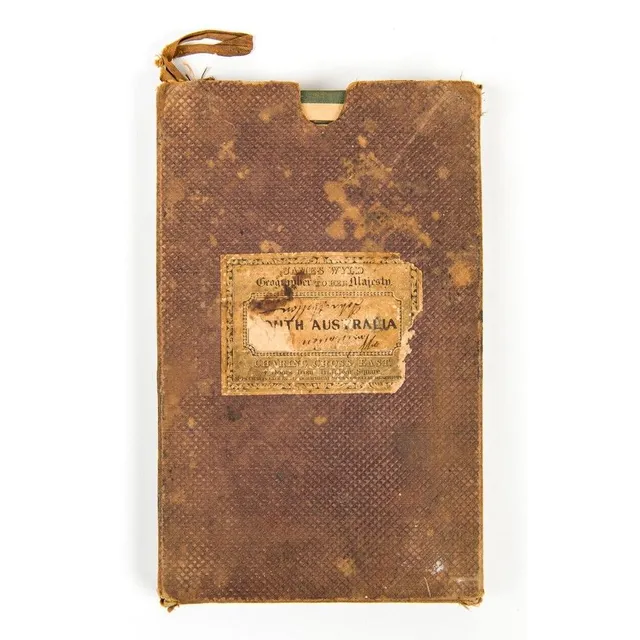
Map of Southern Australia, 1847-48
Map of South Australia, New South Wales, Van Diemen's Land and Settled parts of Australia' by James Wyld (London, 1847-48), engraved map with hand-colouring, dissected and laid down on linen, with original card slip-case with printed label on front.…
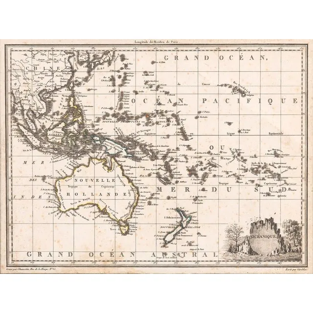
Antique Oceanic and Australasian Maps
c1812-80 maps, noted c1812 'Oceanique', 1838 'Pacific Ocean', 1860 'Carte de la Melanesie', 1875 'Australie Occidentale' & 1880 'Australie et Polynesie'. All window mounted, various sizes. Condition varies.,
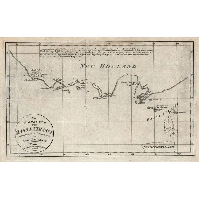
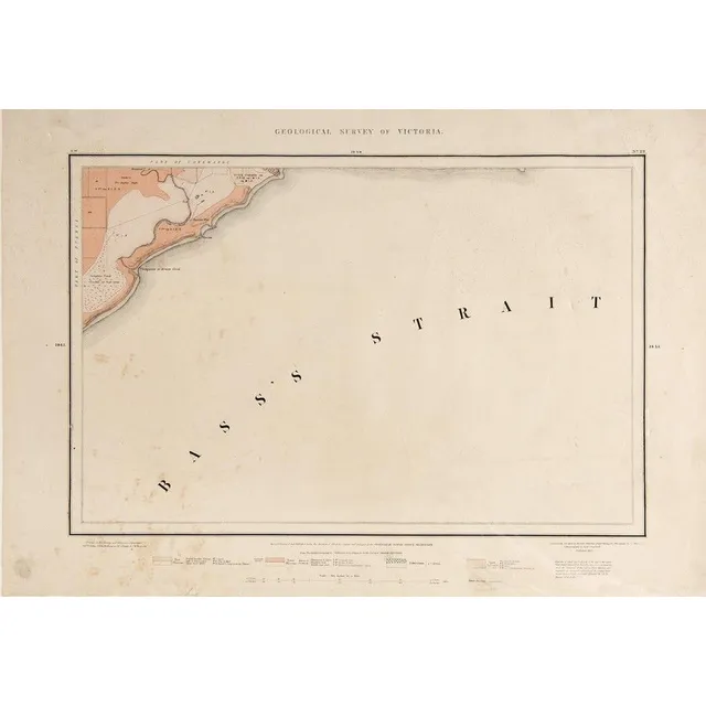
Coast of Victoria map, 1800
Die Nordkuste von Bass's Strasse, aufgenommen im Decemr. 1800 von Lieutn Jac.Grant' (Weimar, 1806), early map of the coast of Victoria with Portland Bay, 29 x 19 cm.,
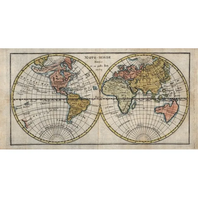
1759 Map of Australia and Pacific Islands
Mappe-Monde, Divisee en ses quatre Partie 1759' (Paris, 1759), double-hemisphere map showing east coast of Australia stretching from Tasmania via New Hebrides to New Guinea, hand-coloured, size 34 x 17 cm.,
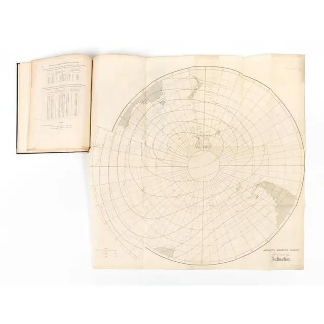
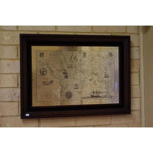
Terrestrial Magnetism Contributions with Antarctic Magnetic Survey Maps
Contributions to Terrestrial Magnetism - No.XI' by Lieut.-General Edward Sabine, from 'P roceedings of the Royal Society of London, 1867', bound with 3 maps 'Antarctic Magnetic Survey, Epoch 1840-1845, Inclination', '..Declination' & '..Intensity'.,
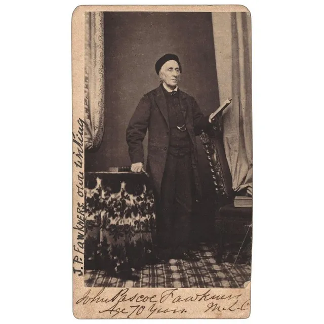
Fawkner Signed Carte de Visite with News Clipping
John Pascoe Fawkner signed carte de visite with inscription verso and accompanying news clipping and envelope,
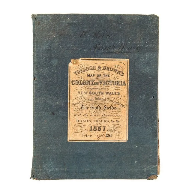
1857 Map of Victoria with Gold Fields and Townships
Tulloch & Brown's Map of the Colony of Victoria Comprising part of New South Wales. Seaport and Inland Townships, the Gold Fields with the latest Discoveries, Roads, Tracks, &e. &c. 1857' (Tulloch & Brown, Melbourne, 1857) large map mounted on linen and…
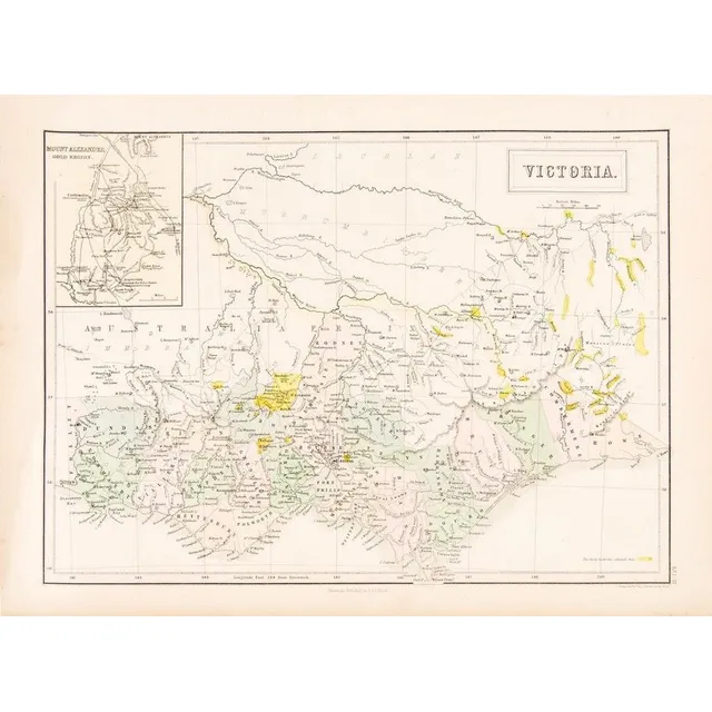
1853 Victoria Goldfields Map by J. Bartholomew
C1853 Goldfields map of Victoria drawn and engraved by J.Bartholomew (Edinburgh), Unframed, 32 x 43 cm
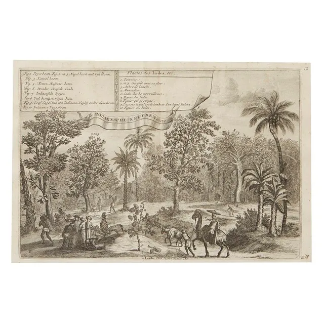
"Indian Plants" and "Java Map" Engravings by Pieter van Der Aa
Two engravings by Pieter van Der Aa, 18th century, 'Plantes Des Indes', Description of Indian plants in French and Dutch by Romeyn de Hooghe (1645-1708), 28.5 x 19 cm, 'Het Eiland Java', a map of the island of Java in French and Dutch after Lopo Vaz de…
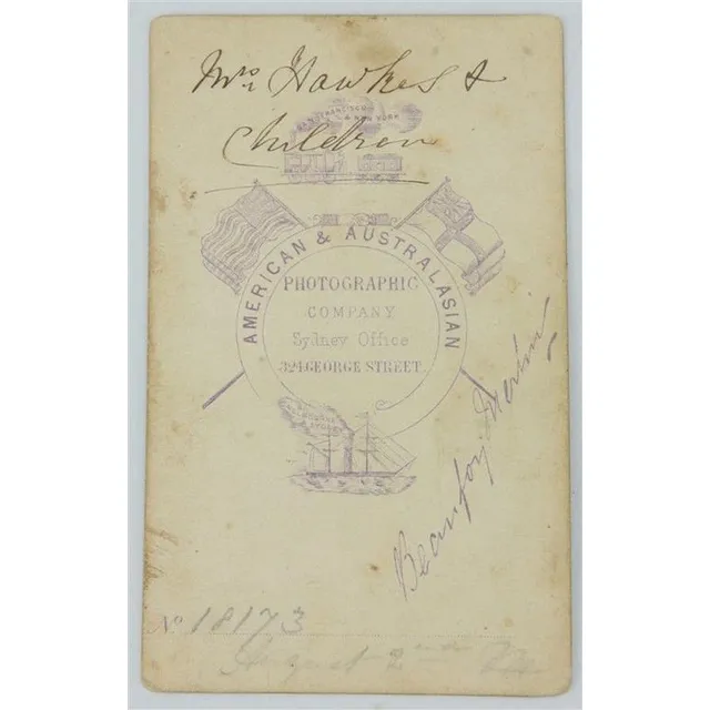
Signed Beaufoy Merlin Carte de Visite, Gulgong, 1872
Beaufoy Merlin 1872 Gulgong Carte de Visite signed to verso 'Mrs Hawkes & children' in Merlin's hand & dated 'August 2nd'. Stamped 'American & Australiasian Photographic Company Sydney Offfice 324 George Street Beaufoy Merlin' numbered '18173'. Rare.…
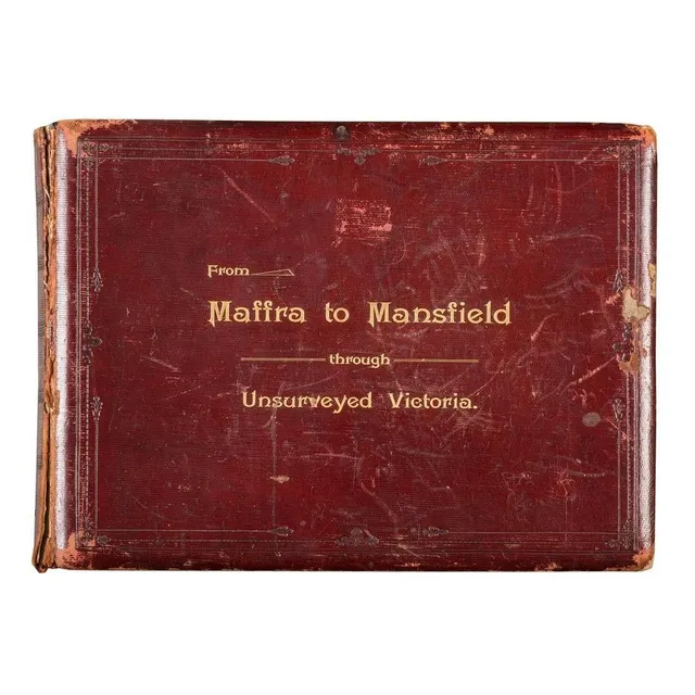
Unsurveyed Victoria: A Horseback Journey in 1890
From Maffra to Mansfield Through Unsurveyed Victoria, A fine, leather bound album with gold embossed title to front cover, circa 1890, with printed title page followed by a tipped-in map showing the route of a survey conducted on horseback with the…
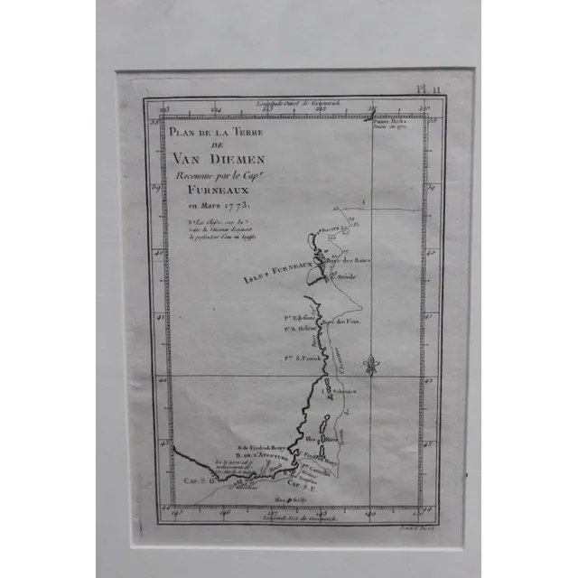
1773 Map of Maria Island, Van Diemens Land
Original map of Maria Island van Diemens Land dated 1773, 24 x 17 cm
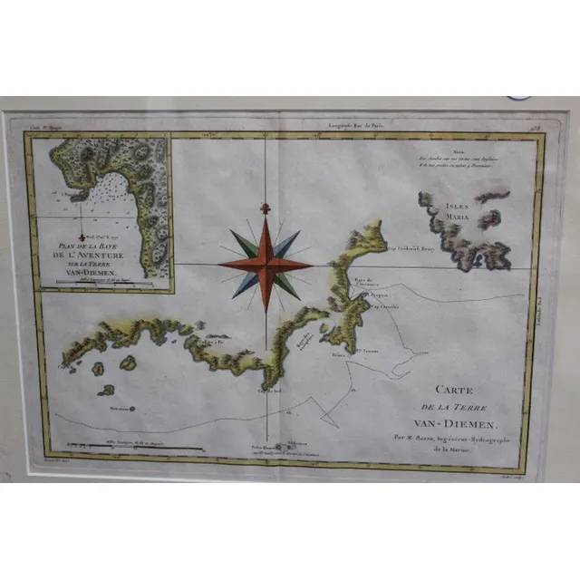
1777 Map of Maria Island, Van Diemens Land
Original map, Maria Island, van Diemens Land dated 1777, 37 x 27 cm
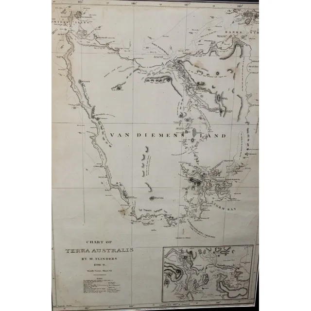
Chart of Terra Australis by M. Flinders 1798
Chart of Terra Australis by M. Flinders 1798, 99 published 1814, G&W Nicol 66 cm x 46 cm
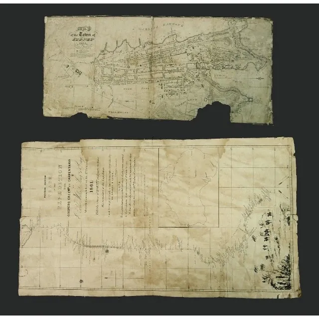
Early Australian Maps: Burke-Wills Expedition & Sydney Town, 1833
Two early Australian Maps. 'Track of the Expedition from Coopers Creek to Carpentaria by Burke, Wills, King & grey.' pub. De Gruchy & Leigh Melbourne, 1861.linen backed, top margin trimmed, stains. Also 'Map of the Town of Sydney, 1833.' engraved by…
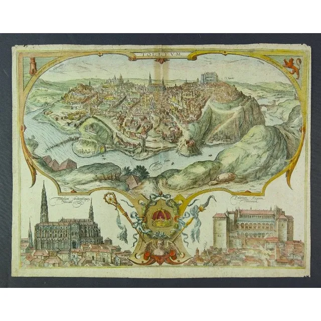
Aerial View of Toledo with Cathedral and Palace, 1598
Circa 1598 Braun & Hogenberg map of Toledo. Hand coloured aerial perspective view of Toledo with vignettes of the Cathedral & Palace. Text verso. Fold line, tear & foxing. Coloured copper engraving. 40 x 52 cm
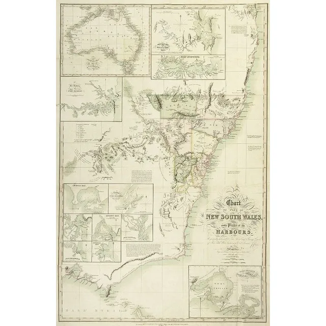
1827 New South Wales Chart with Harbour Plans
1827 Chart of part of New South Wales, with Plans of the Harbours. This is the 1828 issue, engraved & published by Joseph cross, London. Hand coloured engraving. 97 x 65 cm
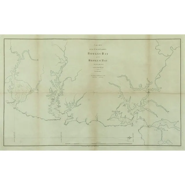
Coastal Chart: Botany Bay to Broken Bay, 1792
1792 Chart of the Coast between Botany Bay & broken Bay. As surveyed by Capt. John hunter. Pub. By John Stockdale, London 1792. Engraving. 43 x 75 cm
South Seas Chart: Monats, Carteret, Cook (1765-69)
Framed Chart of the South Seas. Engraved by Bernard, France. Showing routes taken by Captain Monats 1765, Captain Carteret 1767, Lieutenant Cook 1769. Hand coloured engraving. 69 x 39 cm
Van Diemens Land/Tasmania Map by J. Rapkin/Tallis
Map, 'Van Diemens Land or Tasmania.' J Rapkin / John Tallis. Coloured engraving. 35 x 25 cm
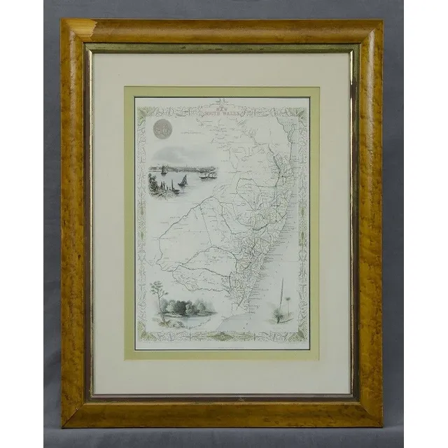
New South Wales Map by Rapkin/Tallis
Map, 'New South Wales.' J Rapkin / John Tallis. Coloured engraving. 35 x 25 cm
Map of New Holland, 1804-5
Map of new Holland circa 1804-5. Showing surveyed & charted areas. Pub. By Arrowsmith and Lewis. Engraving. 20.5 x 25 cm
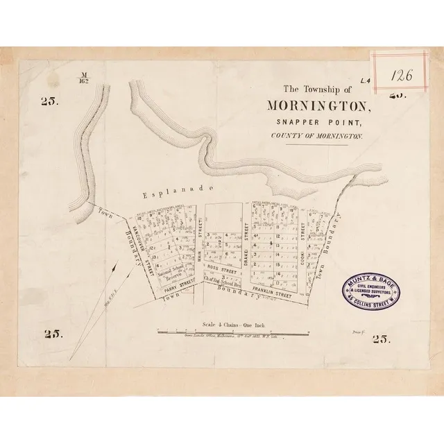
Mornington & Cranbourne Maps (1875-90)
MORNINGTON &CRANBOURNE MAPS: c1875-90 maps, 'The Township of Mornington, Snapper Point', 'Plan of Subdivision of Sections 22 &23 Snapper Point Division', 'Towns of Cranbourne, Parish of Cranbourne, County of Mornington'. Various sizes. Poor/G condition
Australian Maps, 1863-80s: NSW, QLD, VIC, WA, SA, NT
AUSTRALIA MAPS, c1863-80s, noted NSW (3), Queensland, Victoria (2), WA, South Australia &Northern Territory, 'The Overland Route to Australia'
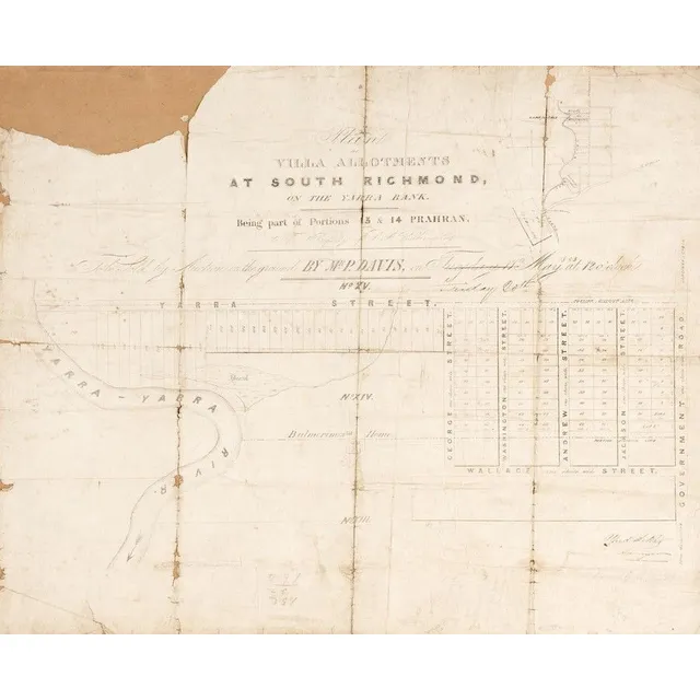
Antique Maps of Richmond, Phillip Island, and Bourke County
MAPS: c1853-84 maps, 'Plan of Villa Allotments at South Richmond', 'Town and Country Lands, Phillip Island', 'Boroondara, County of Bourke'. Various sizes. Poor/G condition
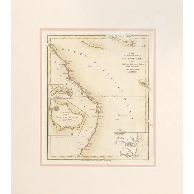
Map of New South Wales and Islands, 1794
A New and Accurate Map of New South Wales, with Norfolk and Lord Howes Islands, Port Jackson &c. from Actual Surveys', by Robert Wilkinson, engraved by T.Foot, published Nov.1st 1794 [London], hand coloured outlines, window mounted, framed &glazed,…
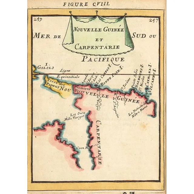
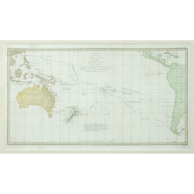
Early Maps of Australia and New Zealand
MALLET MAPS, 'Nouvelle Guinee et Carpentarie'&'Des Terres Australes', by Allain Manesson-Mallet [Paris, 1683], both window mounted, framed &glazed, each about 28 x 34 cm. Early maps showing Australia &NZ
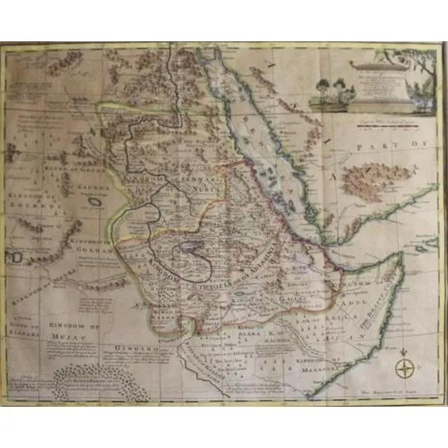
Nubia & Abissinia Map 1747 by Emanuel Bowen
Emanuel Bowen, (1693-1767) English, a new & Accurate map of Nubia & Abissinia 1747, Handcoloured engraving pub. London, 35 x 42.5 cm
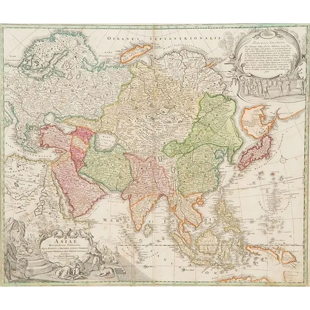
1730 Hand Coloured Map of Asia by Homann
18th century (1730) hand coloured map Asiae Authore Ion. Bapt. Homann 49 x 58 cm
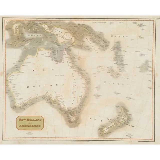
New Holland and Asiatic Isles Map for Thomson's Atlas (1814)
New Holland and Asiatic Isles map drawn & engraved for Thomsons new General Atlas 1814 53 x 66 cm (faults)
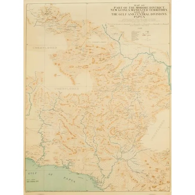
Map of Morobe District and Gulf, New Guinea (1933-1935)
Map of part of the Morobe District New Guinea Mandated Territory and of the Gulf and central Div. 1933-1935. Drawn by J. Nason-Jones, printed by H.E.C Robinson Ltd, 221-3 George Street, Sydney
1942 China Escape Map with Hong Kong, Macao, and Shanghai
A rare escape map of China, including Hong Kong, Macao and Shanghai, printed in 1942 on rayon, 100 x 78 cm (E - M)
Allied Forces' 1942 Southeast Asia Escape Maps (Set of 6)
Six 1942 USA escape maps covering south East Asia, printed on both sides on rayon, issued to all Allied Forces (E - M) (6)
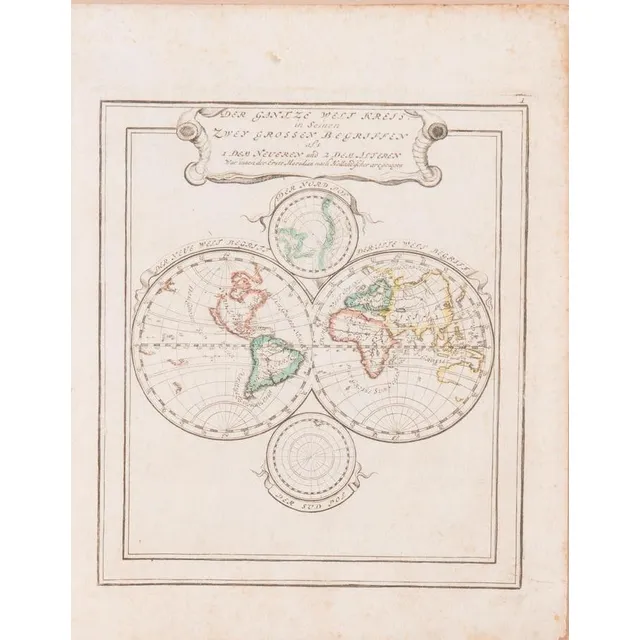
Double Hemisphere World Map with California as Island
Double Hemisphere World Map: 'Der Gantze Welt Kreis in Seinen, Zwey Grossen Begriffen' by Bodenehr [Augsburg, c1704-15], window mounted, framed & glazed, overall 33 x 38 cm. Shows California as an island & west coast of America.
Framed antique maps of Atlantic, Indian and Asian regions
Maps: 'Een Schets van de Algemeene Passaad-Winden in de Atlantische en Indiansche Zeen' by Dampier [1698], 'L'Asie' by Macquart [1739] & 'East Indies' by Jeffreys [1778], all framed, various sizes.
![India Map: 'Tabula Asiae X' by Sebastian Munster [Basle, c1561],…](https://img.carters.com.au/640x640/3bf2627fd529dfd7ea6160d84e16c5ee.webp)
Sebastian Munster's India Map, 1561
India Map: 'Tabula Asiae X' by Sebastian Munster [Basle, c1561], window mounted, framed & glazed, overall 54 x 48 cm.
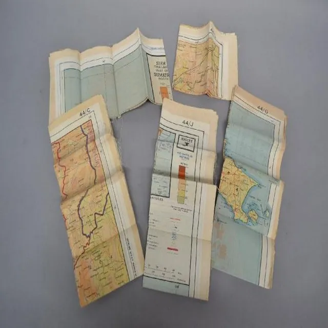
Mint WWII Escape Maps of South East Asia Set
Set of Five World War II escape maps of different areas of South East Asian. All mint condition, unopened
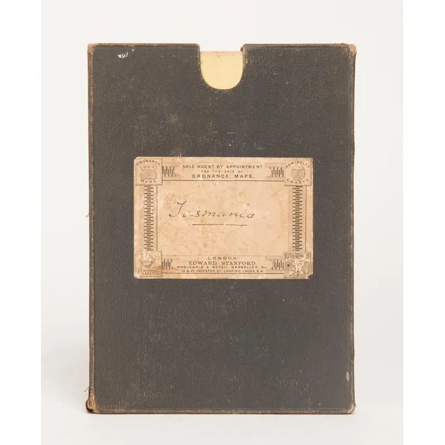
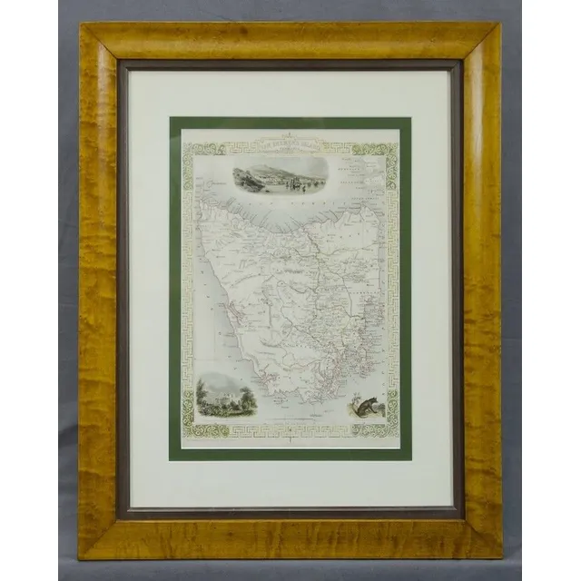
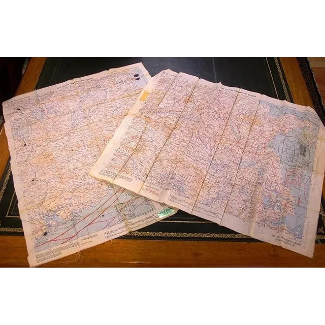
Tasmania 1883 Large Folding Map on Linen
TASMANIA' 1883 large folding map in 30 sectors laid down on linen and contained in a slip-case from the supplier: Edward Stanford Ordnance Maps, Charing Cross. Published by authority of the Honorable N.J.Brown, Minister of Land & Works. Litho: R.Bennett,…
1792 Sydney Cove Map Framed Print
Framed print of 1792 map of Sydney Cove, 65 cm x 54 cm (frame) approx.
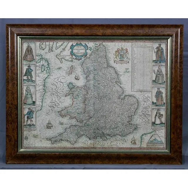
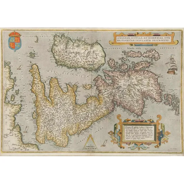
The Kingdom of England
Map, 'The Kingdome of England,' John Speed 1610. Described by Christopher Saxon, augmented by John Speed; with costumed figures vignettes to each side. Hand coloured engraving. 38.5 x 51 cm
World Map 1748 by Bellin
Map, the world, 1748. 'Essay d' Une Carte Reduite Contenant les Partes Connuees du globe Terrestre,' by Jacques-Nicolas Bellin. Coloured copper engraving. 48 x 64 cm
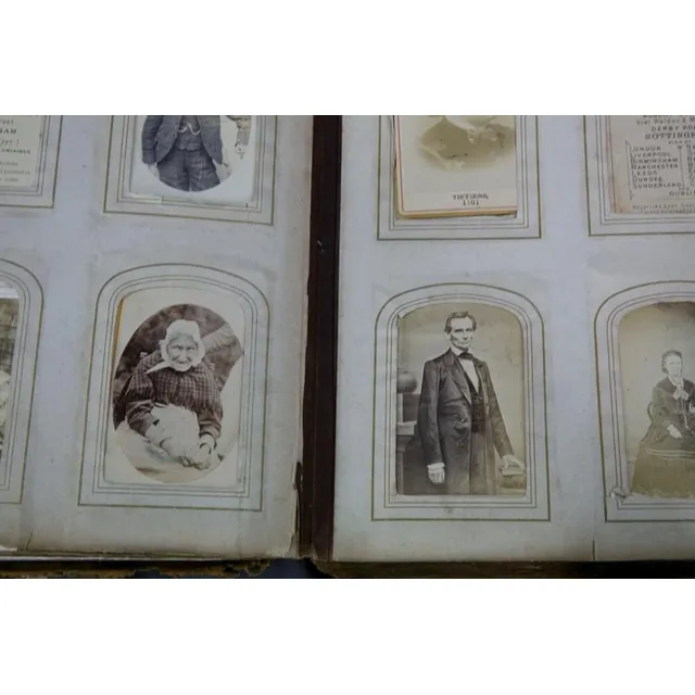
19th Century Cartes de Visite and Famous Figures
Album 19th century photographs etc. Carte de visite, famous figures incl. Lincoln & HRH the Prince of Wales; some explorer & town views, children & animals. Mostly English.
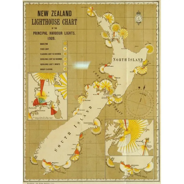
1909 N.Z. Lighthouse Chart in Frame
'N.Z. Lighthouse Chart' the principal harbour lights, 1909, printed in colours by the Marine Department, framed and glazed. 30 cm x 23 cm
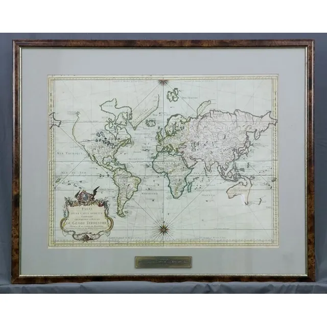
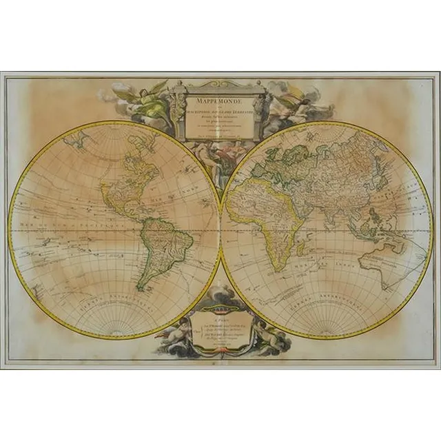
Hand-Coloured Mappemonde Map by Robert de Vaugondy (1752)
Mappemonde map, Robert de Vaugondy (1688-1766), France, circa 1752, hand coloured world map in two hemispheres, the map 47 x 70.5 cm. Provenance: Purchased from the Parker gallery, London, 1979
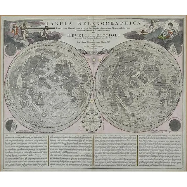
Hand-Coloured Lunar Map by Johann Gabriel Doppelmair
Tabula Selenographica, Johann Gabriel Doppelmair (1671-1750), Nuremberg, circa 1742, hand coloured engraved double-hemisphere of the lunar surface, vertical seam to centre, the map, 47.5 x 59 cm. Provenance: Purchased from Baynton- Williams, London in the…
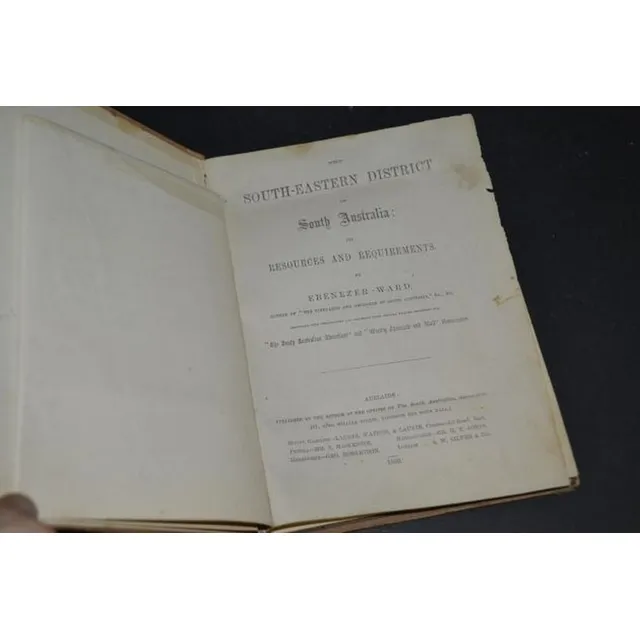
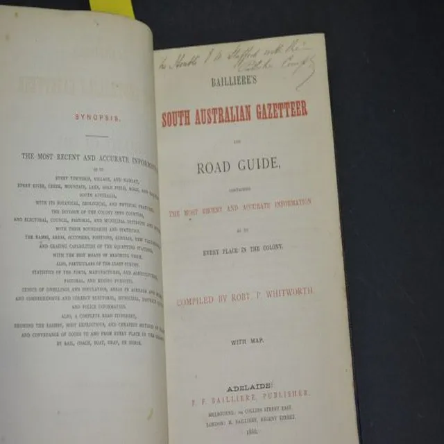
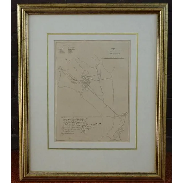
South-Eastern District of South Australia (1869)
Ebenezer Ward 'The South-Eastern District of South Australia' 1869 with 1867 map
Framed Paterson, Unframed Surrounding Maps Set
Framed Paterson map, along with unframed Dungog, Newcastle, lake Macquarie and singleton
Italian Flag & Map Prints Collection
A group of 9 framed Italian flag & map prints, various sizes. Largest frame: 79 x 64 cm.
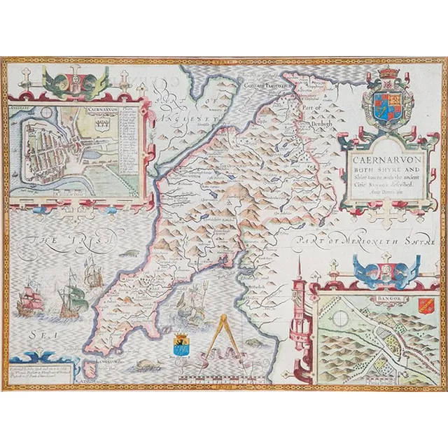
Antique Hand-Coloured Map of Caernarvon-Shire by John Spede
Hand coloured antique map of Caernarvon-Shire by John Spede, 38 x 51 cm
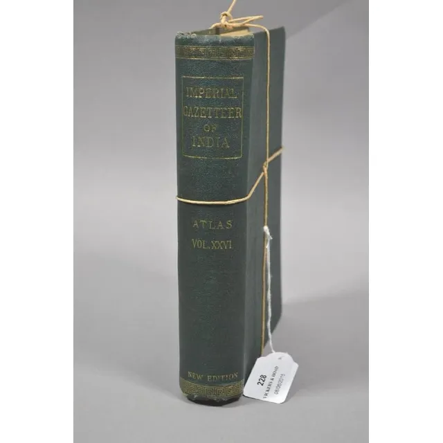
India's Imperial Gazetteer Atlas, 1932
The Imperial Gazetteer of India. Volume XXVI Atlas, 1932. Hardcover. Many detailed maps together with all sorts of information concerning the pre Independence pricey states etc.
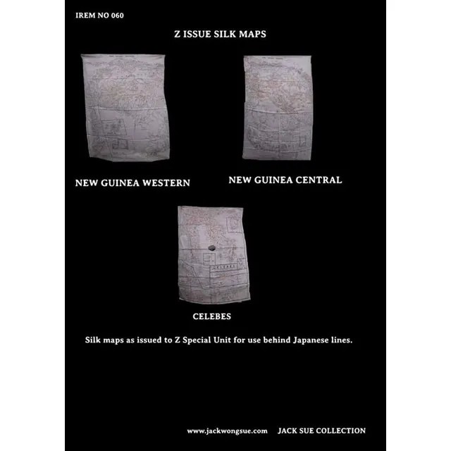
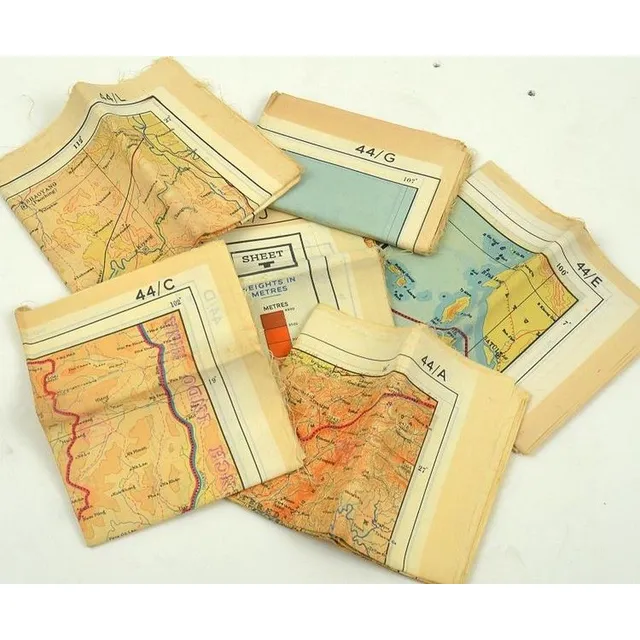
Z Special Unit's Unique Silk Maps
3 silk Maps. These maps were issued to Z special Unit for use behind Japanese lines Whilst many silk maps were used during World War II, these ones were unique to Z special Unit in that they were passed on to Jack by fellow Z man Jack Bickford
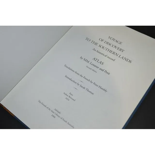
Peron's Atlas (Facsimile Edition)
Facsimile edition - Peron, The Atlas only 1824 (2008) bound in half leather no. 18 of 150
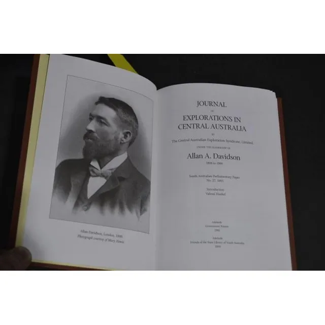
Central Australia Exploration Journal with Maps (Facsimile Edition)
Allan A. Davidson - Journal of Explorations in central Australia 1905 (2004 facsimile edition) no. 18 of 99, bound in quarter leather with separate facsimile edition of the maps (two)
Antique Hand Coloured Maps of British Isles and Munster
Two framed antique hand coloured maps of the British Isles & the Province of Munster. Frames approximately 182 cm x 67 cm
Chart of Pacific Ocean with Cook's voyages and incomplete coastlines
Map: 'Chart of the Pacific Ocean' circa 1820 showing New Holland with incomplete northern and southern coastlines and only the east coast of Van Diemen's Land; Papua or New Guinea largely incomplete; Japan, Philippines, eastern China and the north and…
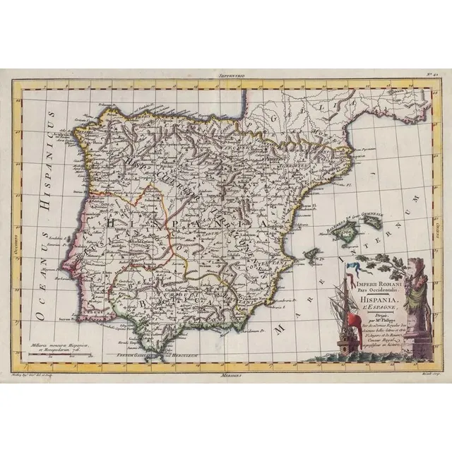
Imperii Romani Pars Occidentalis: Hispania Map (c.1780)
Map: 'Imperii Romani Pars Occidentalis. Hispania. L'Espagne' engraved map published by Moithey [Paris, c1780], size 44 x 28 cm.
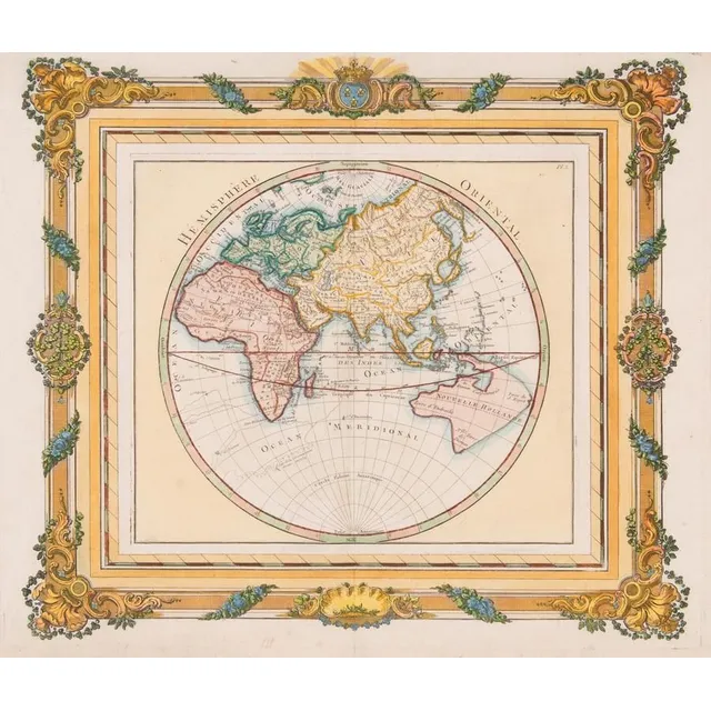
French Hemisphere Oriental Map, 1768
Map: A French hand coloured map 'Hemisphere Oriental', circa 1768, attributed to Brion de la Tour, pre Captain Cook with undefined east coast of Australia. 42 x 36 cm
Sterling Silver World Map by RGS (1976)
Royal Geographic Society sterling silver world map circa 1976, marked 925/1000, 51 cm x 70 cm (frame)
Sketch of Van Diemens Land History and Arrowsmith Map
Book, 1832, sketch of the History of van Diemens Land, James Bischoff, including Arrowsmith map, separately mounted
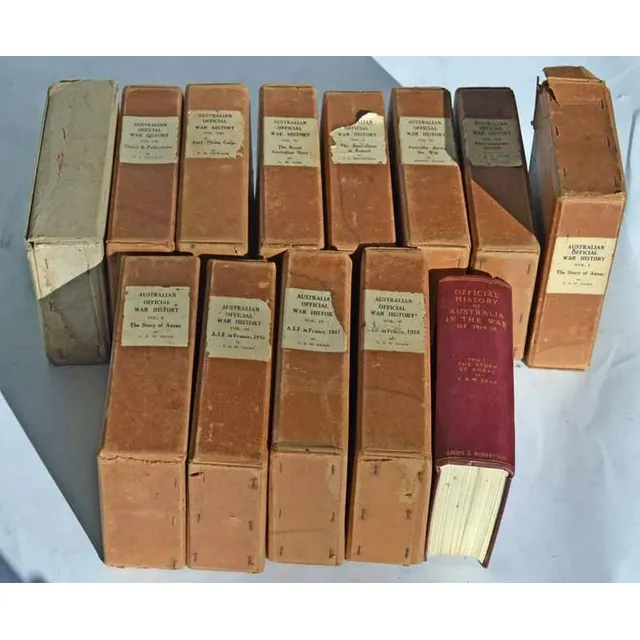
The Story of Anzac: C.E.W. Bean's 12 Volumes
Charles Edwin Woodrow bean (C.E.W. Bean) 1879 - 1968. The story of Anzac; 12 volumes with original covers 'From the outbreak of war to the end of the first phase of the Gallipoli campaign, May 4, 1915', with 111 maps and 56 illustrations Ninth edition,…
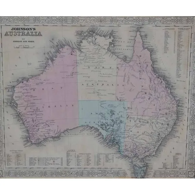
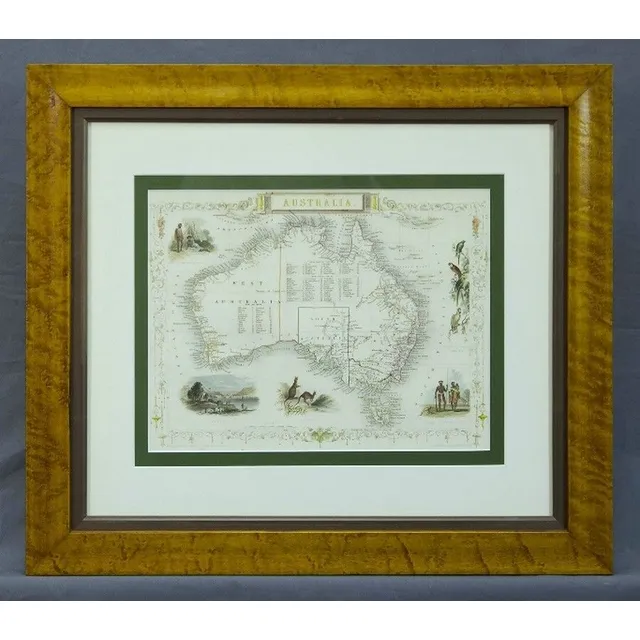
Antique Framed Maps: Australia & World with Cook's Routes
i) A 'Johnson's Australia' framed map, c.1864, by Johnson & Ward hand coloured engraved print. 32 x 40 cm (image); ii) 'The world on Mercator's Projection' framed map Published 1816 London, by C.S. Smith hand coloured engraved print note: showing Capt.…
Accurate Map of Asia, 1799
Thomes Bowen (?-1790) A new and Accurate map of Asia, drawn from the most modern Maps and Charts, 1799 Handcoloured & engraved, for Middletons complete System of Geography 32.5 x 42.5 cm
Herman Moll's 1719 World Map
Map, New & Correct Map of the Whole World. Made or published by Herman Moll, London, 1719. Four joined sheets, hand coloured. Various repaired tears & small losses to the margins. 73 x 123 cm

Hawthorn-Prahran 1887 Map Set
Hawthorn - Prahran circa 1887. Two canvas backed maps scale 400 feet to an inch, stone engraved by Clarence Woodhouse [printed by John Batton 79 Queen St], housed in original black cloth covered boards with gilt lettering.
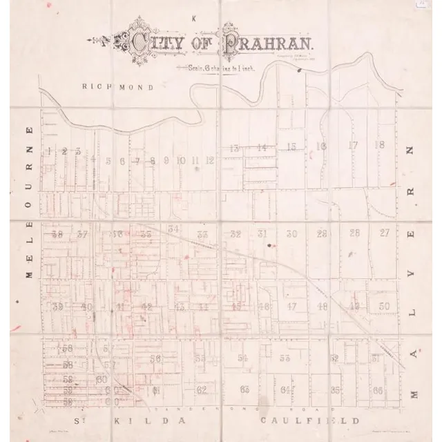
Prahran City Map 1882
City of Prahran. Compiled by T. B. Muntz, City Surveyor, 1882, fold-up map in 16 sections on linen-backing, with many properties added in red ink, overall 83 x 90 cm.
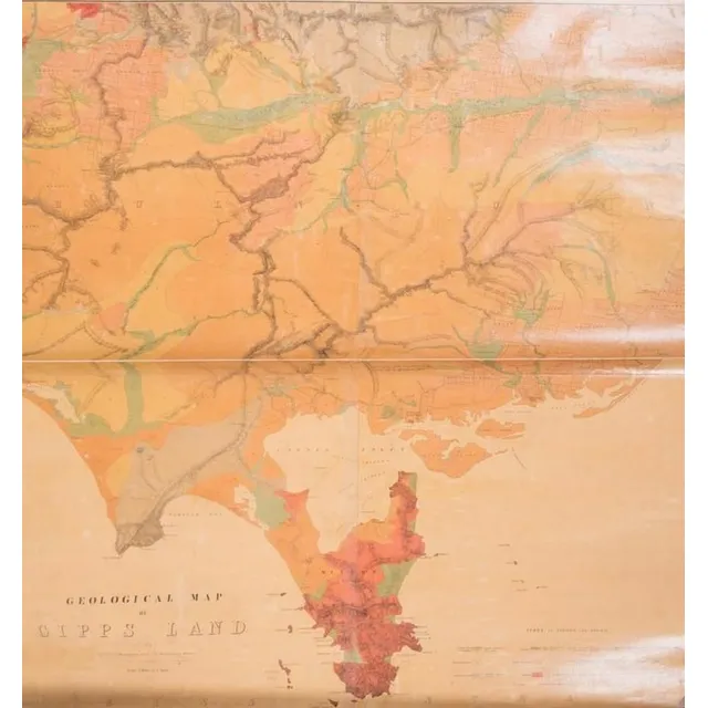
Gipps Land Geological Map (c.1875)
Geological Map of Gipps Land (Sheet No.1), Surveyed by R. A. F. Murray under the direction of the Mining department, Melbourne [c1875], linen-backed roll-up map, size 97 x 110 cm.
![Carte Generale De L'Oceanie by Brue [Paris 1827]. 52 x 58 cm](https://img.carters.com.au/640x640/39579bcec98bcd6dcbac9d546d8c9d6a.webp)
Oceanie Map by Brue [Paris 1827] - 52 x 58 cm
Carte Generale De L'Oceanie by Brue [Paris 1827]. 52 x 58 cm
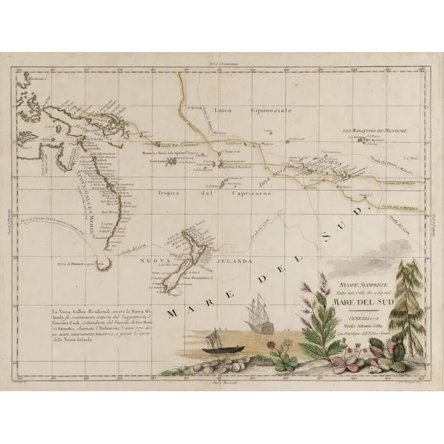
"Mare Del Sud" Map by Antonio Zatta (1776)
Italian 18th century map of the South Sea titled 'Mare Del Sud' by Antonio Zatta [Venice 1776]. 42 x 32 cm
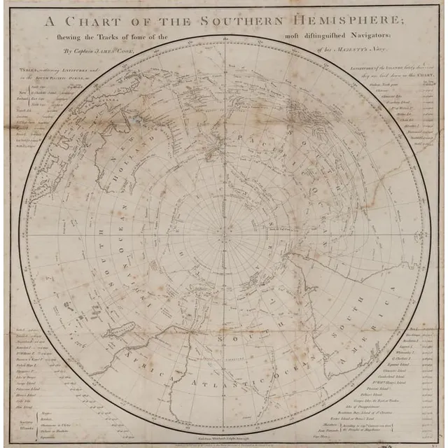
Captain Cook's Southern Hemisphere Chart (1777)
A Chart of the Southern Hemisphere by Captain James Cook, published by William Strahan [London 1777]. 55 x 57 cm
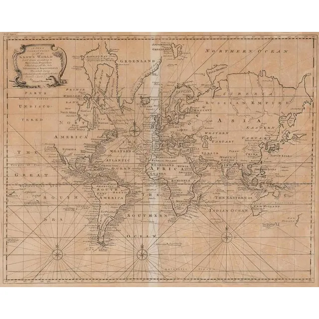
Emanuel Bowen's World Map, London 1744
A New & Correct Chart of all the Known World by Emanuel Bowen [London 1744]. 46 x 38 cm
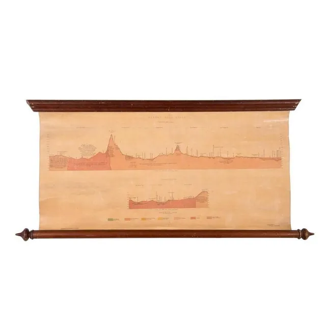
Ararat Gold Field Map, 1875
Ararat Gold Field, Section Ab on Plan, Section Cd on Plan. Lithographed at the Mining Department, Melbourne. Ferdinand M. Krause, Geol. Surveyor, Ararat, June 1875, linen-backed roll-up map, size 69 x 35 cm.
18th Century Topographical Maps and Strategic Plans
Twenty antique Topographical Maps and Strategic Plans, 18th century, including ten engraved maps of Europe from Thomas Bankes's 'New System of Geography' and ten plans of French and Flemish towns, St Omer, Mons, Eckern, Oudenard, Tournay, Menin, Daway,…
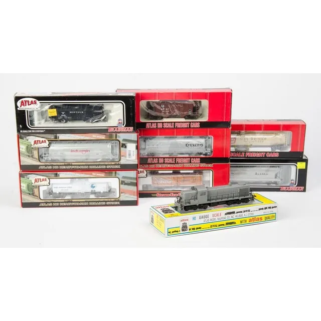
Atlas Diesel and Rolling Stock Set - NIB
Atlas: Rsd 4/5 diesel no.7080 (Undecorated) together with rolling stock: 33,000 Gal. Tank car (Suburban Propane), 3-Bay cylindrical Hoppers (Indusmin & New York System), 36' wood Reefer car (Evansville packing), Kaolin tank car (Anglo-American Clays),…
Centurion's Global Journey: Hand-Colored Chart by Rw Seale
Framed hand coloured Chart, the Track of the Centurion round the world. Engraver Rw Seale
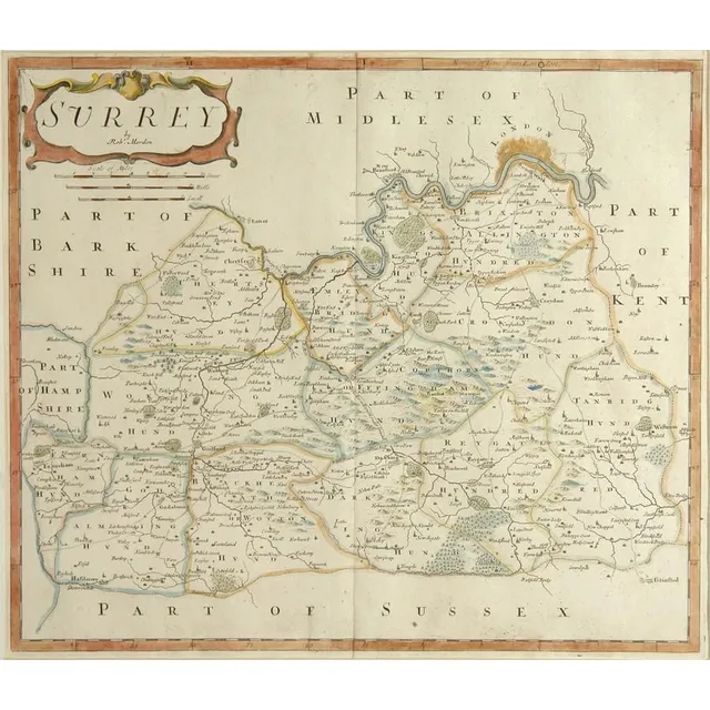
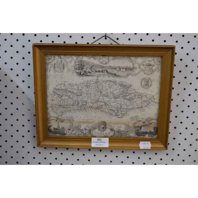
18th Century Sussex Map by Robert Morden
An 18th century map 'Part of Sussex' by Robert Morden, hand coloured in outline. 36 cm x 41 cm
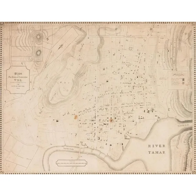
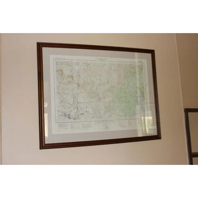
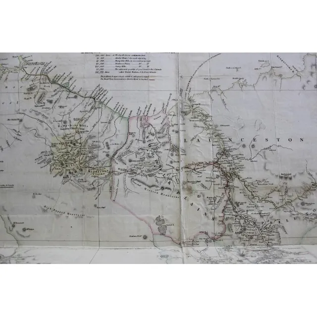
Launceston Town Map, Van Diemen's Land, 1855
A colonial surveyor's map, 'Plan of the town of Launceston, Van Diemen's Land, from the actual survey by H. W. H. Smythe, 1855', 64 cm high, 78 cm wide
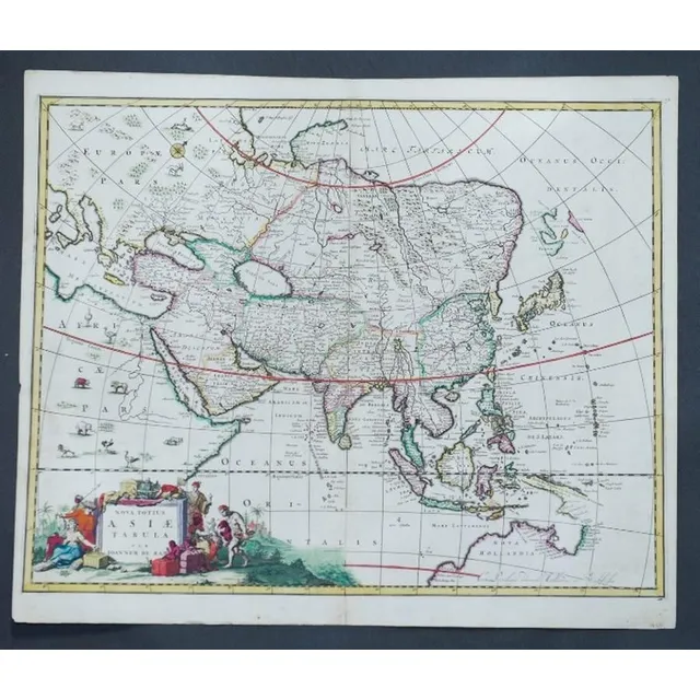
1690 Hand-Coloured Map of Asia by Joannem de Ram
Map, Asia, Joannem de ram Novatotius Asiae Tabula, published Amsterdam c.1690. Hand coloured engraving. 46 x 5 7 cm
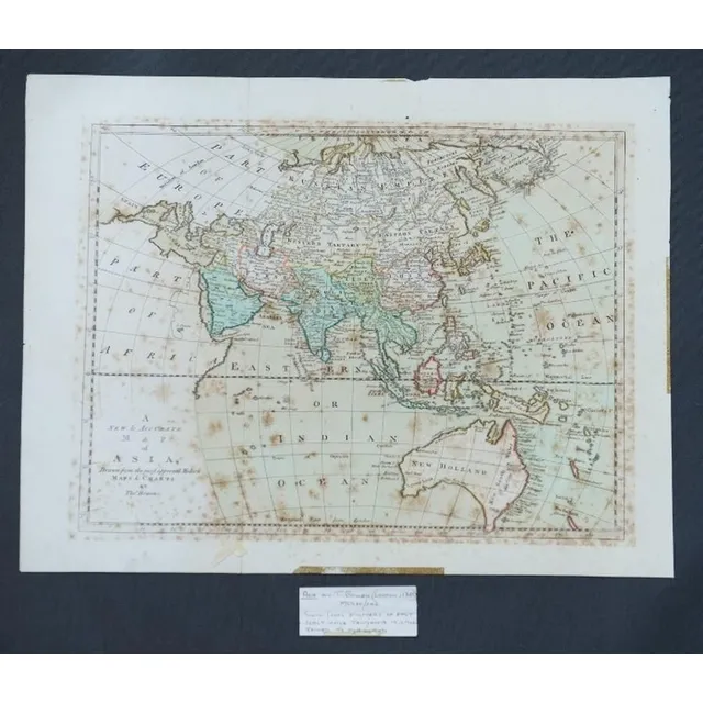
Accurate Map of Asia, Bowen, London c.1790
Map, a new and Accurate map of Asia. Thomas Bowen, London. Pub. C.1790. Copper engraving & hand coloured. 33 x 4 3 cm
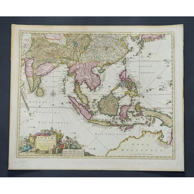
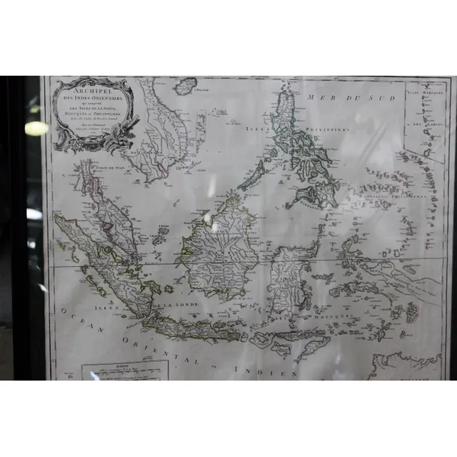
New Map of East India and Adjacent Islands, 1670
Map, Indiae Orientalis nec Non Insularum Adiacentium Nova Descriptio. Map maker Nicholaus Visscher, pub. Amsterdam, 1670. Hand coloured engraving. 48 x 5 8 cm
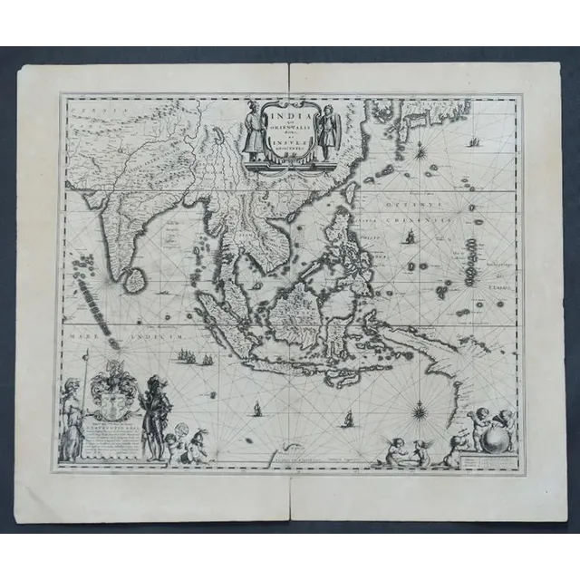
India and Adjacent Islands Map by Blaeu, c.1635
Map, India Quae Orientalis et Insulae Adiacinte. Mapmaker, Willem Janszoon Blaeu, c.1635. Engraving. 43 x 5 2 cm

Map of NSW, New Zealand, New Hebrides & Adjacent Islands
Map, NSW, New Zealand, New Hebrides & the Islands Adjacent. Robert Wilkinson, pub. London 1808. Inset map of port Jackson & Environs. Coloured engraving
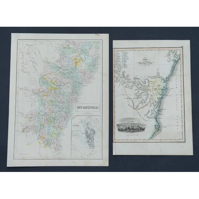
NSW Map with Sydney Inset and Goldfields (1855)
MapS (2), NSW, Bartholomew, pub. Edinburgh. Has inset map of Sydney. Indicates goldfields c.1855; & NSW by W.H. Lizars, pub. Edinburgh c.1824. R.H. Margin missing. Coloured engraving. 38 x 2 7 cm. & 30 x 2 2 cm
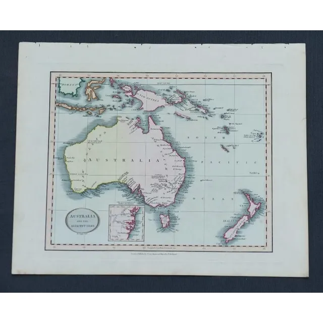
Australia & Adjacent Isles Map, 1819
Map, Australia & the Adjacent Isles. John Cary, pub. London 1819. Hand coloured steel engraving. 26 x 3 2 cm
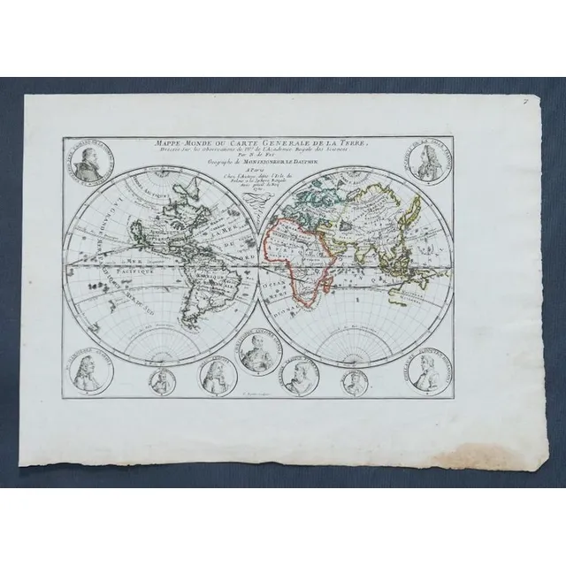
1700 French World Map with Explorer Cartouches
Map, Mappe-Monde Ou Carte Generale de La Terre. Pub. France c.1700. General world view with cartouches of explorers. Copper engraving & hand coloured. 24 x 3 5 cm
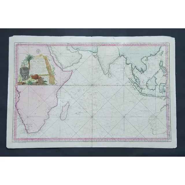
Eastern Ocean Map, Bellin, Paris 1757
Map, Carte Reduite de L'Ocean Oriental ou Mer des Indes. Mapmaker J N Bellin, pub. Paris, 1757. Hand coloured engraving. 56 x 8 8 cm
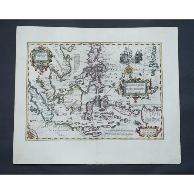
Eastern Islands of Moluccae
Map, Insulae Indaie Orientalis in Quibus Moluccae Celeberrimae Sunt. Mapmaker Hondius, pub. Amsterdam 1613. Hand coloured engraving. 35 x 4 8 cm
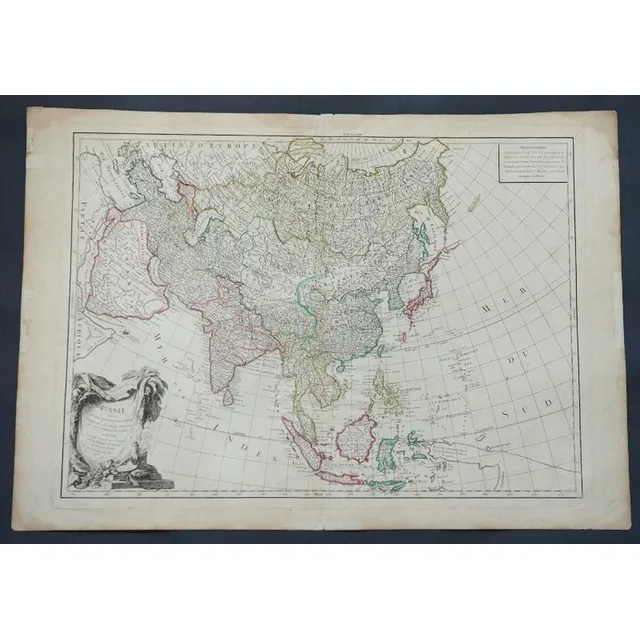
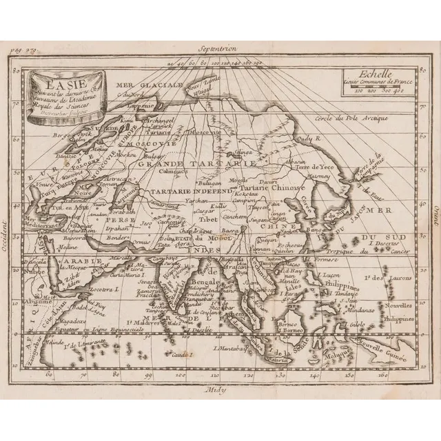
Asia's Main States
Map, L'Asie Divisee en ses pair of incipaux Etats. Mapmaker, Jean Janvier, pub. Paris 1760. Hand coloured engraving. 49 x 6 8 cm